Back Lago di Campotosto Danish Lago di Campotosto German Lago de Campotosto Spanish Campotosto järv Estonian Campotostoko aintzira Basque Lac de Campotosto French Lago de Campotosto Galician Lago di Campotosto Italian Meer van Campotosto Dutch Campotostosjøen NN
| Lake Campotosto | |
|---|---|
 | |
| Location | Abruzzo |
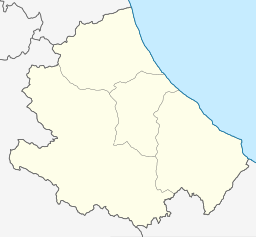
| Coordinates | 42°31′51″N 13°23′00″E / 42.53083°N 13.38333°E |
| Type | reservoir |
| Primary inflows | Fucino |
| Primary outflows | Fucino |
| Catchment area | 47.5 km2 (18.3 sq mi) |
| Basin countries | Italy |
| Surface area | 14 km2 (5.4 sq mi) |
| Max. depth | 38 m (125 ft) |
| Water volume | 230 million cubic metres (190,000 acre⋅ft) |
| Surface elevation | 1,313 m (4,308 ft) |
Lago di Campotosto ("Toughfield Lake") is an artificial lake in Abruzzo, Italy. The reservoir is located at an elevation of 1,313 m and comprises an area of 14 square kilometres. It is located in the natural park known as the "Gran Sasso e Monti della Laga National Park".
The lake is reachable via the Italian State Highway 80 from either L'Aquila or the Adriatic Coast. Smaller roads lead to Capitignano, Montereale and Amatrice.
