| Lake Martin | |
|---|---|
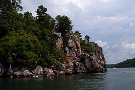
 Acapulco Rock and Chimney Rock at the lake | |
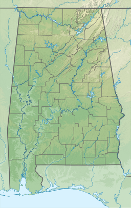
| Location | Coosa / Elmore / Tallapoosa counties, Alabama, United States |
| Coordinates | 32°45′59.37″N 85°54′3.85″W / 32.7664917°N 85.9010694°W |
| Type | Reservoir |
| Primary inflows | Tallapoosa River |
| Primary outflows | Tallapoosa River |
| Basin countries | United States |
| Max. length | 31 mi (50 km) |
| Surface area | 44,000 acres (18,000 ha) |
| Average depth | 41 ft (12 m) |
| Max. depth | 155 ft (47 m) |
| Shore length1 | 743 mi (1,196 km) |
| Settlements | Alexander City, Jackson's Gap, Dadeville |
| 1 Shore length is not a well-defined measure. | |
| Martin Dam | |
|---|---|
| Founded | 1923 |
| Official name | Martin Dam |
| Designated | January 5, 1976[1] |
Lake Martin is located in Tallapoosa, Elmore and Coosa counties in Alabama. It is a 44,000-acre (178 km2) reservoir with over 750 miles (1,200 km) of wooded shoreline. Lake Martin is a reservoir, enlarged by the construction of Martin Dam on the Tallapoosa River. The Martin Dam powerhouse is used to generate hydroelectric power for the Alabama Power Company. Construction on Martin Dam began in 1923 and was completed in 1926, creating what was, at that time, the largest human-made body of water in the world. Originally known as Cherokee Bluffs for the geological formation upon which it was built, the dam was renamed in 1936 in honor of Thomas Martin, the then-president of Alabama Power Company.[2] Alabama Power and Russell Lands own some of the shoreline.
- ^ "Alabama Register of Landmarks and Heritage as of April 7, 2023" (PDF). ahc.alabama.gov. Retrieved 17 March 2024.
- ^ "Lake Martin" Archived 2012-03-19 at the Wayback Machine, Alabama Power Company

