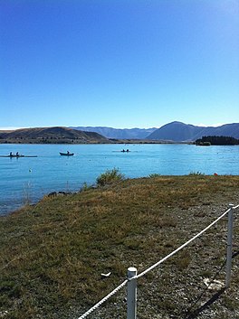
| Lake Ruataniwha | |
|---|---|
 Rowing on Lake Ruataniwha | |
| Location | South Island |
| Coordinates | 44°16′52″S 170°04′16″E / 44.281°S 170.071°E |
| Type | Artificial lake |
| Primary inflows | Ōhau River |
| Basin countries | New Zealand |
| Surface area | 3.4 km2 (1.3 sq mi) |
| Surface elevation | 458 m (1,503 ft) |
Lake Ruataniwha is an artificial lake in the Mackenzie Basin in the South Island of New Zealand. It was formed in 1977–1981 as part of the Waitaki hydroelectric project.[1] It lies on the traditional boundary of the Canterbury and Otago provinces, with the town of Twizel two kilometres to the north.
The lake takes its name from the Ruataniwha Station, a large sheep-station in the area, part of which the NZ Electricity Department purchased as the site for the township of Twizel (founded in 1968). Ruataniwha was a Māori chief who drowned when the canoe Arai-te-uru sank near Moeraki in the 12th century CE.[2]
- ^ Sheridan, Page 325.
- ^ Sheridan, Marion (1995). Dam Dwellers: End of an Era ; Living with Hydro-electricity Development in the Waitaki Valley and Mackenzie Country. Twizel: Sheridan Press. p. 309. ISBN 9780473034023. Retrieved 12 August 2019.

