Back لانغفورد (كولومبيا البريطانية) Arabic Langford (lungsod sa Kanada) CEB Langford (British Columbia) German Langford (Columbia Británica) Spanish لنگفورد Persian Langford (Colombie-Britannique) French Langford (Canada) Italian Langfordas Lithuanian Langford (Canada) Dutch Langford (Kanada) Polish
Langford | |
|---|---|
| City of Langford | |
 Langford in 2012 | |
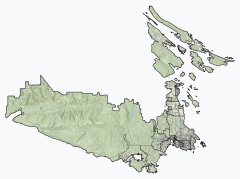
Location of Langford within the Capital Regional District | |
| Coordinates: 48°27′2″N 123°30′21″W / 48.45056°N 123.50583°W | |
| Country | Canada |
| Province | British Columbia |
| Regional district | Capital |
| Founded | 1851 |
| Incorporated | December 8, 1992 |
| Government | |
| • Governing body | Langford City Council |
| • Mayor | Scott Peter Goodmanson |
| • Councillors | Colby Harder, Mary Wagner, Keith Yacucha, Kimberley Guiry, Mark Morley, Lillian Szpak |
| Area | |
| • Total | 41.43 km2 (16.00 sq mi) |
| Elevation | 76 m (249 ft) |
| Population | |
| • Total | 46,584 |
| • Density | 1,124.4/km2 (2,912/sq mi) |
| Demonym(s) | Langfordite, Langfordian |
| Time zone | UTC−8 (PST) |
| • Summer (DST) | UTC−7 (PDT) |
| Postal code | V9B, V9C |
| Area code(s) | 250, 778, 236, 672 |
| Highways | |
| Waterways | Saanich Inlet |
| Website | langford |
Langford is a city on southern Vancouver Island in the province of British Columbia, Canada. Langford is one of the 13 component municipalities of Greater Victoria and is within the Capital Regional District. Langford was incorporated in 1992 and has a population of over 40,000 people. Its municipal neighbours are Colwood to the southeast, Highlands to the north, Metchosin to the southwest, and View Royal to the northeast.
- ^ a b "Langford, City [Census subdivision], British Columbia and Capital, Regional district [Census division], British Columbia". Statistics Canada. February 8, 2023. Retrieved March 20, 2023.


