Lawrence Heights | |
|---|---|
Neighbourhood | |
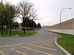
 View of Leila Lane in Lawrence Heights | |
 | |
| Country | |
| Province | |
| City | Toronto |
| Municipality established | 1850 York Township |
| Changed municipality | 1922 North York from York Township |
| Changed municipality | 1998 Toronto from North York |
Lawrence Heights is a neighbourhood in Toronto, Ontario, Canada. It is located north-west of central Toronto, in the district of North York. The neighbourhood is roughly bounded by Lawrence Avenue to the south, Yorkdale Road to the north, Varna Drive to the east and Dufferin Street to the west. It is part of the greater Yorkdale-Glen Park official Toronto neighbourhood.
The area is divided into two distinct subsections. One half of the neighbourhood is a post World War II development of bungalows and storey-and-a-half dwellings. As the frontage of these homes average 45 feet, the area has had significant changes as older houses are torn down and replaced by "Monster Homes" as the area's proximity to major city arteries and the downtown core make it lucrative to builders. The other housing area, which is east of Flemington Road, is short-term public housing. Because of the area's proximity to Downsview Airport, high-rise buildings were not originally permitted to be constructed in this area, and the majority of the housing is in low to mid-rise buildings.
