Back ليكانغر Arabic Leikanger BAR Leikangeris BAT-SMG Лейкангер Byelorussian Лейкангер BE-X-OLD Лейкангер Bulgarian Leikanger BJN লেইকাঙ্গের BPY Leikanger Catalan Leikanger CEB
Leikanger Municipality
Leikanger kommune | |
|---|---|
 View of Hermansverk | |
|
| |
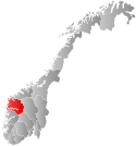
 Sogn og Fjordane within Norway | |
 Leikanger within Sogn og Fjordane | |
| Coordinates: 61°13′51″N 06°47′23″E / 61.23083°N 6.78972°E | |
| Country | Norway |
| County | Sogn og Fjordane |
| District | Sogn |
| Established | 1 Jan 1838 |
| • Created as | Formannskapsdistrikt |
| Disestablished | 1 Jan 2020 |
| • Succeeded by | Sogndal Municipality |
| Administrative centre | Hermansverk |
| Government | |
| • Mayor (2015-2019) | Jon Håkon Odd (Ap) |
| Area (upon dissolution) | |
| • Total | 180.10 km2 (69.54 sq mi) |
| • Land | 177.44 km2 (68.51 sq mi) |
| • Water | 2.66 km2 (1.03 sq mi) 1.5% |
| • Rank | #342 in Norway |
| Population (2019) | |
| • Total | 2,331 |
| • Rank | #302 in Norway |
| • Density | 13.1/km2 (34/sq mi) |
| • Change (10 years) | |
| Demonym | Systrending[1] |
| Official language | |
| • Norwegian form | Nynorsk |
| Time zone | UTC+01:00 (CET) |
| • Summer (DST) | UTC+02:00 (CEST) |
| ISO 3166 code | NO-1419[3] |
Leikanger (Urban East Norwegian: [ˈlæ̂ɪkɑŋər] ) is a former municipality in Sogn og Fjordane county, Norway. It was located on the northern shore of the Sognefjorden in the traditional district of Sogn. The administrative center was the village of Hermansverk, which also was the administrative center of the old Sogn og Fjordane county.
The Leikanger/Hermansverk urban area had 2,144 inhabitants (2019), about 90% of the municipal population.[4] This urban area is often called Systrond, which is why a person from Leikanger is often called Systrending.
The 180-square-kilometre (69 sq mi) municipality is the 342nd largest by area out of the 422 municipalities in Norway. Leikanger is the 302nd most populous municipality in Norway with a population of 2,331. The municipality's population density is 13.1 inhabitants per square kilometre (34/sq mi) and its population has increased by 8.1% over the last decade.[5][6]
- ^ "Navn på steder og personer: Innbyggjarnamn" (in Norwegian). Språkrådet.
- ^ "Forskrift om målvedtak i kommunar og fylkeskommunar" (in Norwegian). Lovdata.no.
- ^ Bolstad, Erik; Thorsnæs, Geir, eds. (26 January 2023). "Kommunenummer". Store norske leksikon (in Norwegian). Kunnskapsforlaget.
- ^ Statistisk sentralbyrå (1 January 2016). "Urban settlements. Population and area, by municipality".
- ^ Statistisk sentralbyrå (2018). "Table: 06913: Population 1 January and population changes during the calendar year (M)" (in Norwegian). Retrieved 8 December 2019.
- ^ Statistisk sentralbyrå. "09280: Area of land and fresh water (km²) (M)" (in Norwegian). Retrieved 8 December 2019.

