Native name: Pulau Lepar | |
|---|---|
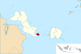
 Location of Lepar in Bangka-Belitung | |
| Geography | |
| Coordinates | 2°57′S 106°49′E / 2.950°S 106.817°E |
| Area | 169.3 km2 (65.4 sq mi) |
| Administration | |
| Province | Bangka Belitung Islands |
| Regency | South Bangka |
| District | Lepar Pongok |
| Demographics | |
| Population | 6,603 |
| Pop. density | 39/km2 (101/sq mi) |
Lepar (Indonesian: Pulau Lepar) is an island in Indonesia, located off the southeastern coast of Bangka. Administratively part of South Bangka in Bangka Belitung province, it is the third-largest island in the province after its much larger namesakes Bangka and Belitung, with an area of 169 square km. Lepar sits in the Gaspar Strait which separates the two larger islands. It stretches about 22 km east–west and 17 km north–south, with the towns of Tanjunglabu, Tanjungsangkar and Penutuk being the main population centers. It is governed as its own district of Lepar Pongok, which used to include a nearby, medium-sized island of Pongok until 2012 when it separated as its own district of Pongok Islands.[1]
- ^ "Pemekaran Lepar Pongok. Pulau Celagen Masuk Kecamatan Baru". Radar Bangka (in Indonesian). 10 March 2012. Retrieved 2 October 2017.
