Back Lexington, Missouri Afrikaans لكسينغتون (ميزوري) Arabic لكسينجتون (ميزورى) ARZ لکزینقتون، میزوری AZB Лексингтън (Мисури) Bulgarian Lexington (Missouri) Catalan Лексингтон (Миссури) CE Lexington (kapital sa kondado sa Tinipong Bansa, Missouri) CEB Lexington, Missouri Welsh Lexington (Missouri) German
This article needs additional citations for verification. (July 2023) |
Lexington, Missouri | |
|---|---|
 The Lafayette County Courthouse in Lexington, MO | |
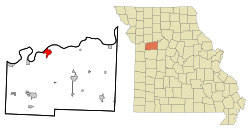
 Location of Lexington, Missouri | |
| Coordinates: 39°11′04″N 93°52′20″W / 39.18444°N 93.87222°W | |
| Country | United States |
| State | Missouri |
| County | Lafayette |
| Government | |
| • Mayor | David Goodloe |
| Area | |
| • Total | 5.46 sq mi (14.13 km2) |
| • Land | 5.23 sq mi (13.54 km2) |
| • Water | 0.23 sq mi (0.59 km2) |
| Elevation | 810 ft (250 m) |
| Population (2020) | |
| • Total | 4,652 |
| • Density | 889.82/sq mi (343.54/km2) |
| Time zone | UTC-6 (Central (CST)) |
| • Summer (DST) | UTC-5 (CDT) |
| ZIP code | 64067 |
| Area code | 660 |
| FIPS code | 29-41870[3] |
| GNIS feature ID | 2395697[2] |
| Website | lexingtonmo |

Lexington is a city in, and the county seat of, Lafayette County, Missouri, United States.[4] The population was 4,726 at the 2010 census. Located in western Missouri, Lexington lies approximately 40 miles (64 km) east of Kansas City and is part of the Kansas City metropolitan area. It is the home of the Battle of Lexington State Historic Site, and of the former Wentworth Military Academy and College, which operated from 1880 to 2017.[5]
- ^ "ArcGIS REST Services Directory". United States Census Bureau. Retrieved August 28, 2022.
- ^ a b U.S. Geological Survey Geographic Names Information System: Lexington, Missouri
- ^ "U.S. Census website". United States Census Bureau. Retrieved January 31, 2008.
- ^ "Find a County". National Association of Counties. Archived from the original on May 31, 2011. Retrieved June 7, 2011.
- ^ History of Wentworth Military Academy, by James M. Sellers, Jr., 1984.