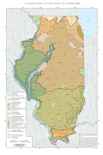
The list of ecoregions in Illinois are lists of terrestrial ecoregions (see also, ecosystem) of the United States' State of Illinois, as defined separately by the United States Environmental Protection Agency (USEPA), and by the World Wildlife Fund. Illinois' ecology is in a land area of 56,400 square miles (146,000 km2); the state is 385 miles (620 km) long and 218 miles (351 km) wide and is located between latitude: 36.9540° to 42.4951° N, and longitude: 87.3840° to 91.4244° W,[1] with primarily a humid continental climate.
- ^ About Illinois Data and Statistics, retrieved 2013-02-10