Back Neamere ANG بحيرة لوك ناي Arabic بحيره لوك ناى ARZ Лох Ней Bulgarian Loch nEathach Breton Neagh Catalan Lough Neagh CEB Lough Neagh Czech Лох-Ней CV Lough Neagh Welsh
| Lough Neagh | |
|---|---|
| |
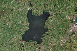
 ESA Sentinel-2 image | |
| Location | Northern Ireland, UK |
| Coordinates | 54°37′06″N 6°23′43″W / 54.61833°N 6.39528°W |
| Type | Fresh Water Lough/Lake |
| Primary inflows | Upper Bann, Six Mile Water, Glenavy River, Crumlin River, Blackwater, Moyola River, Ballinderry River, River Main[2] |
| Primary outflows | Lower Bann |
| Catchment area | 1,760 sq mi (4,550 km2) |
| Basin countries |
|
| Max. length | 19 mi (30 km) |
| Max. width | 9.3 mi (15 km) |
| Surface area | 151 sq mi (392 km2) |
| Average depth | 30 ft (9 m) |
| Max. depth | 82 ft (25 m) |
| Water volume | 776,000,000 imp gal (3.528 hm3) |
| Shore length1 | 78 mi (125 km) |
| Surface elevation | 48.0 ft (14.63 m) |
| Islands | (see below) |
| Official name | Lough Neagh & Lough Beg |
| Designated | 5 January 1976 |
| Reference no. | 74[3] |
| 1 Shore length is not a well-defined measure. | |
Lough Neagh (/lɒx ˈneɪ/ lokh NAY; Irish: Loch nEathach [l̪ˠɔx ˈn̠ʲaha(x)]) is a freshwater lake in Northern Ireland and is the largest lake on the island of Ireland and in the British Isles. It has a surface area of 148 square miles (383 square kilometres)[4] and is about 19 miles (31 km) long and 9 miles (14 km) wide. According to Northern Ireland Water, it supplies 40.7% of Northern Ireland's drinking water. Its main inflows are the Upper River Bann and Blackwater, and its main outflow is the Lower Bann. There are several small islands, including Ram's Island, Coney Island and Derrywarragh Island. The lake bed is owned by the 12th Earl of Shaftesbury[5] and the lake is managed by Lough Neagh Partnership.[6] Its name comes from Irish Loch nEachach [ˌl̪ˠɔx ˈn̠ʲahəx], meaning "Eachaidh's lake".[7]
- ^ Naijural Heirship: Peat Mosses Archived 6 September 2012 at the Wayback Machine NI Environment and Heritage Service.
- ^ "Flora of Northern Ireland". habitas.org.uk. Archived from the original on 6 March 2012. Retrieved 18 September 2009.
- ^ "Lough Neagh & Lough Beg". Ramsar Sites Information Service. Retrieved 25 April 2018.
- ^ "Lough Neagh Catchment Map | Department of Agriculture, Environment and Rural Affairs". DAERA. 30 May 2024. Retrieved 3 December 2024.
- ^ "Lough Neagh's future still up in air after owner meets minister". Belfast Telegraph. 10 April 2014.
- ^ "Home – Lough Neagh Partnership".
- ^ Deirdre Flanagan and Laurance Flanagan, Irish Placenames, (Gill & Macmillan Ltd, 1994)
