Back Lower Nazareth Township, Pennsylvania Welsh Municipio de Lower Nazareth Spanish Ловер-Назарет Тауншип (округ Нортемптон, Пенсільванія) Ukrainian Xã Lower Nazareth, Quận Northampton, Pennsylvania Vietnamese
Lower Nazareth Township | |
|---|---|
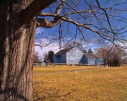
 Louise W. Moore Park in Lower Nazareth Township in February 2011 | |
 | |
| Coordinates: 40°42′30″N 75°22′36″W / 40.70833°N 75.37667°W | |
| Country | |
| State | |
| County | Northampton |
| Founded | 1807 |
| Area | |
| • City | 13.59 sq mi (35.19 km2) |
| • Land | 13.46 sq mi (34.87 km2) |
| • Water | 0.12 sq mi (0.32 km2) |
| Elevation | 397 ft (121 m) |
| Population (2010) | |
| • City | 5,674 |
| • Estimate (2016)[2] | 6,111 |
| • Density | 453.84/sq mi (175.23/km2) |
| • Metro | 865,310 (US: 68th) |
| Time zone | UTC-5 (EST) |
| • Summer (DST) | UTC-4 (EDT) |
| Area code(s) | 610 |
| FIPS code | 42-095-45024 |
| Primary airport | Lehigh Valley International Airport |
| Major hospital | Lehigh Valley Hospital–Cedar Crest |
| School district | Nazareth Area |
| Website | www |
Lower Nazareth Township is a township in Northampton County, Pennsylvania, United States. The population of Lower Nazareth Township was 5,674 at the 2010 census. The township is located in the Lehigh Valley, which had a population of 861,899 and was the 68th-most populous metropolitan area in the U.S. as of the 2020 census.
- ^ "2016 U.S. Gazetteer Files". United States Census Bureau. Retrieved August 14, 2017.
- ^ "Population and Housing Unit Estimates". Retrieved June 9, 2017.
