Back ماهبوبناجار ARZ महबूबनगर जिला Bihari মাহবুবনগর জেলা Bengali/Bangla Districte de Mahbubnagar Catalan Mahbūbnagar (distrito) CEB Mahabubnagar (Distrikt) German Distrito de Mahbubnagar Spanish Mahbubnagar barrutia Basque بخش محبوبنگر Persian Mahbubnagarin piirikunta Finnish
Mahabubnagar district | |
|---|---|
 Mallela Theertham waterfall | |
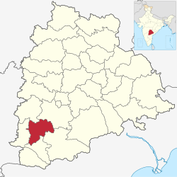
 Location in Telangana | |
| Country | |
| State | |
| Headquarters | Mahabubnagar |
| Mandalas | 16 |
| Government | |
| • District collector | Ravi Gugulothu IAS |
| Area | |
| • Total | 2,738 km2 (1,057 sq mi) |
| Population (2011)[1] | |
| • Total | 919,903 |
| • Density | 340/km2 (870/sq mi) |
| Time zone | UTC+05:30 (IST) |
| Vehicle registration | TG–06[2] |
| Website | mahabubnagar |
Mahabubnagar district also known as Palamuru district is a district in the Indian state of Telangana. Mahabubnagar is the district headquarters which is popularly known as Palamoor.[3] The district shares boundaries with Narayanapet, Vikarabad, Rangareddy, Nagarkurnool, Wanaparthy and Jogulamba Gadwal districts. The district was formed during the period of the 6th Nizam of Hyderabad State – Nawab Mir Mahbub Ali Khan and hence named after him.
- ^ "At A Glance | Mahabubnagar District,Telangana | India". Retrieved 15 September 2020.
- ^ "Vehicle Registration Codes For New Districts In Telangana". Sakshipost. Retrieved 16 February 2019.
- ^ "Official website of Mahabubnagar district". National Informatics center. Retrieved 14 August 2015.
