Manotick | |
|---|---|
Community | |
 | |
| Coordinates: 45°13′35″N 75°41′11″W / 45.22639°N 75.68639°W | |
| Country | Canada |
| Province | Ontario |
| City | Ottawa |
| Established | 1830s |
| Incorporated | 1903 (Police Village of Manotick) |
| Amalgamation | 1974 (Township of Rideau) 2001 (City of Ottawa) |
| Government | |
| • MPs | Pierre Poilievre |
| • MPPs | Goldie Ghamari |
| • Councillors | David Brown |
| Area | |
| • Total | 6.717 km2 (2.593 sq mi) |
| Elevation | 95 m (312 ft) |
| Population (2021) | |
| • Total | 5,315 |
| • Density | 791.229/km2 (2,049.27/sq mi) |
| Canada 2021 Census | |
| Time zone | UTC−5 (Eastern (EST)) |
| • Summer (DST) | UTC−4 (EDT) |
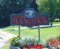
Manotick (/ˈmænətɪk/ MAN-ə-tik[1]) is a community in Rideau-Jock Ward in the rural south part of the City of Ottawa, Ontario, Canada. It is a suburb of the city, located on the Rideau River, immediately south of the suburbs Barrhaven and Riverside South, about 25 km (16 mi) from downtown Ottawa.[2] It was founded by Moss Kent Dickinson in 1864. He named the village 'Manotick', after the Algonquin word for 'island'. It has been part of the City of Ottawa since amalgamation in 2001. Prior to that, it was located in Rideau Township. According to the Canada 2016 Census, Manotick had a population of 4,486.[3]
- ^ "Manotick - Ottawa Real Estate - Ottawa Living". YouTube. Archived from the original on 2021-12-13. Retrieved 8 September 2019.
- ^ Manotick Official Plan Amendment #3 Archived 2012-02-22 at the Wayback Machine. City of Ottawa, 2003. Retrieved on 2009-03-31.
- ^ "Census Profile, 2016 Census - 5050201.00 [Census tract], Ontario and Canada [Country]". 8 February 2017.

