Back مارلو (نيوهامشير) Arabic Marlow (Nou Hampshire) Catalan Марлоу (Нью-Гэмпшир) CE Marlow (lungsod sa Tinipong Bansa, New Hampshire) CEB Marlow, New Hampshire Welsh Marlow (Nuevo Hampshire) Spanish Marlow (New Hampshire) French Marlow, New Hampshire HT Marlow (New Hampshire) Italian Марлоу (Нью-Гэмпшир) Kazakh
Marlow, New Hampshire | |
|---|---|
Town | |
 Main Street in 1907 | |
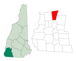
 Location in Cheshire County, New Hampshire | |
| Coordinates: 43°06′57″N 72°11′49″W / 43.11583°N 72.19694°W | |
| Country | United States |
| State | New Hampshire |
| County | Cheshire |
| Incorporated | 1761 |
| Communities |
|
| Government | |
| • Board of Selectmen |
|
| Area | |
| • Total | 26.4 sq mi (68.5 km2) |
| • Land | 26.0 sq mi (67.3 km2) |
| • Water | 0.5 sq mi (1.2 km2) 1.78% |
| Elevation | 1,161 ft (354 m) |
| Population (2020)[2] | |
| • Total | 749 |
| • Density | 29/sq mi (11.1/km2) |
| Time zone | UTC-5 (Eastern) |
| • Summer (DST) | UTC-4 (Eastern) |
| ZIP code | 03456 |
| Area code | 603 |
| FIPS code | 33-45700 |
| GNIS feature ID | 0873660 |
| Website | www |
Marlow is a town in Cheshire County, New Hampshire, United States. The population was 749 at the 2020 census.[2] Marlow is home to Honey Brook State Forest.
- ^ "2021 U.S. Gazetteer Files – New Hampshire". United States Census Bureau. Retrieved November 4, 2021.
- ^ a b "Marlow town, Cheshire County, New Hampshire: 2020 DEC Redistricting Data (PL 94-171)". U.S. Census Bureau. Retrieved November 4, 2021.