Back منطقة ماثورا Arabic ماثورا ARZ मथुरा जिला AWA मथुरा जिला Bihari মথুরা জেলা Bengali/Bangla Districte de Mathura Catalan Mathura (distrito) CEB Mathura (distrikt) Danish Mathura (Distrikt) German Distrito de Mathura Spanish
Mathura district | |
|---|---|
|
Clockwise from top:
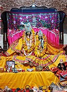
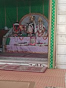
Mansi Ganga in Goverdhan, Radha Kund, Radha Krishna Vivah Sthali, Bhandirvan, Gokula, Barsana, Vrindavan, Yamuna ghat, Kusum Sarovar | |
 Location of Mathura district in Uttar Pradesh | |
| Country | |
| State | Uttar Pradesh |
| Division | Agra |
| Headquarters | Mathura |
| Tehsils | 5 |
| Government | |
| • Lok Sabha constituencies | Mathura |
| Area | |
| • Total | 3,333 km2 (1,287 sq mi) |
| Population (2011) | |
| • Total | 2,547,185[1] |
| Demographics | |
| • Literacy | 74.65%.[1] |
| Language | |
| • Official | Hindi |
| • Local | Braj Bhasha |
| Time zone | UTC+05:30 (IST) |
| Website | mathura |
Mathura district is situated along the banks of the river Yamuna is a district of Uttar Pradesh state of north-central India. The historic city of Mathura is the district headquarters. Mathura district is home to many important sites associated with goddess Radha and Lord Krishna, who was born in Mathura and grew up in the nearby town of Vrindavan. Both cities are some of the most sacred sites in the Vaishnava tradition, making Mathura district an important Hindu pilgrimage centre.[2]
The District is part of Agra division. Total area of Mathura district is 3340 sq. km.[3] There are 5 tehsils in Mathura district.
- Mathura
- Govardhan
- Chhata
- Mant
- Mahavan.[4] Mathura is bounded on the northeast by Aligarh District, on the southeast by Hathras District, on the south by Agra District, and on the west by Rajasthan and northwest by Haryana state.
- ^ a b Cite error: The named reference
districtcensuswas invoked but never defined (see the help page). - ^ Gopal, Madan (1990). K.S. Gautam (ed.). India through the ages. Publication Division, Ministry of Information and Broadcasting, Government of India. p. 176.
- ^ "District Mathura, Government of Uttar Pradesh | Birth Place of Lord Sri Krishna | India". Retrieved 16 March 2021.
- ^ "Tehsil | District Mathura, Government of Uttar Pradesh | India". Retrieved 16 March 2021.


