Back مقاطعة مكدونا (إلينوي) Arabic McDonough County, Illinois BAR Макдъна (окръг, Илинойс) Bulgarian ম্যাকডনৌঘ কাউন্টি, ইলিনয়স BPY McDonough Gông (Illinois) CDO Макдоно (гуо, Иллинойс) CE McDonough County CEB McDonough County, Illinois Welsh McDonough County German Condado de McDonough Spanish
McDonough County | |
|---|---|
 | |
 Location within the U.S. state of Illinois | |
 Illinois's location within the U.S. | |
| Coordinates: 40°28′N 90°41′W / 40.46°N 90.68°W | |
| Country | |
| State | |
| Founded | January 25, 1826 |
| Named for | Thomas Macdonough |
| Seat | Macomb |
| Largest city | Macomb |
| Area | |
| • Total | 590 sq mi (1,500 km2) |
| • Land | 589 sq mi (1,530 km2) |
| • Water | 0.8 sq mi (2 km2) 0.1% |
| Population (2020) | |
| • Total | 27,238 |
| • Density | 46/sq mi (18/km2) |
| Time zone | UTC−6 (Central) |
| • Summer (DST) | UTC−5 (CDT) |
| Congressional districts | 15th, 17th |
| Website | mcg |
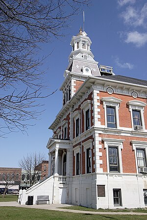
McDonough County is a county in the U.S. state of Illinois. According to the 2020 census, it had a population of 27,238.[1] Its county seat is Macomb,[2] which is also the home of Western Illinois University.
McDonough County is part of the Macomb, IL Micropolitan Statistical Area.
- ^ "McDonough County, Illinois". United States Census Bureau. Retrieved June 10, 2023.
- ^ "Find a County". National Association of Counties. Archived from the original on May 31, 2011. Retrieved June 7, 2011.
