Back ميسيلا (نيومكسيكو) Arabic مسیلا، نیومکزیکو AZB Mesilla Catalan Месилла (Нью-Мексико) CE Mesilla (lungsod sa Tinipong Bansa) CEB Mesilla, New Mexico Welsh Mesilla German Mesilla (Nuevo México) Spanish Mesilla (Mexiko Berria) Basque مسیلا، نیومکزیکو Persian
Mesilla | |
|---|---|
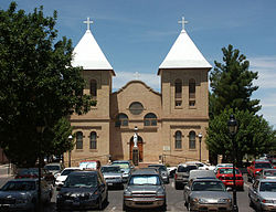
 Basilica of San Albino, on the Mesilla plaza | |
 Location within Doña Ana County and New Mexico | |
| Coordinates: 32°15′32″N 106°48′53″W / 32.25889°N 106.81472°W | |
| Country | United States |
| State | New Mexico |
| County | Doña Ana |
| Government | |
| • Mayor | Russell Hernandez [1] |
| Area | |
| • Total | 5.68 sq mi (14.71 km2) |
| • Land | 5.68 sq mi (14.71 km2) |
| • Water | 0.00 sq mi (0.00 km2) |
| Elevation | 3,881 ft (1,183 m) |
| Population | |
| • Total | 1,797 |
| • Density | 316.43/sq mi (122.18/km2) |
| Time zone | UTC-7 (Mountain (MST)) |
| • Summer (DST) | UTC-6 (MDT) |
| ZIP code | 88046 |
| Area code | 575 |
| FIPS code | 35-48060 |
| GNIS feature ID | 2412988[3] |
| Website | mesillanm |
Mesilla (also known as La Mesilla and Old Mesilla) is a town in Doña Ana County, New Mexico, United States. The population was 2,196 at the 2010 census.[5] It is part of the Las Cruces Metropolitan Statistical Area.
During the Civil War, Mesilla briefly served as capital of the Confederate Territory of Arizona.
The Mesilla Plaza is a National Historic Landmark.
- ^ "Board of Trustees- Town of Mesilla". dev.mesillanm.gov. Retrieved December 29, 2019.
- ^ "ArcGIS REST Services Directory". United States Census Bureau. Retrieved October 12, 2022.
- ^ a b U.S. Geological Survey Geographic Names Information System: Mesilla, New Mexico
- ^ Cite error: The named reference
USCensusDecennial2020CenPopScriptOnlywas invoked but never defined (see the help page). - ^ "Geographic Identifiers: 2010 Demographic Profile Data (G001): Mesilla town, New Mexico". U.S. Census Bureau, American Factfinder. Archived from the original on February 13, 2020. Retrieved November 3, 2015.
