Back ميشين بيند (تكساس) Arabic میشن بند، تکزاس AZB Mission Bend Catalan Мишен-Бенд (Техас) CE Mission Bend CEB Mission Bend Spanish میشن بند، تگزاس Persian Mission Bend French Mission Bend (Teksas) Croatian Mission Bend, Texas HT
Mission Bend, Texas | |
|---|---|
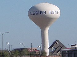
 A Mission Bend water tower | |
 Location in Harris County and the state of Texas | |
| Coordinates: 29°41′37″N 95°39′42″W / 29.69361°N 95.66167°W | |
| Country | United States |
| State | Texas |
| Counties | Fort Bend, Harris |
| Area | |
| • Total | 4.9 sq mi (12.7 km2) |
| • Land | 4.9 sq mi (12.6 km2) |
| • Water | 0.04 sq mi (0.1 km2) |
| Elevation | 95 ft (29 m) |
| Population (2020) | |
| • Total | 36,914 |
| • Density | 7,500/sq mi (2,900/km2) |
| Time zone | UTC-6 (Central (CST)) |
| • Summer (DST) | UTC-5 (CDT) |
| FIPS code | 48-48772[1] |
| GNIS feature ID | 1867556[2] |
Mission Bend is a census-designated place (CDP) around Texas State Highway 6 within the extraterritorial jurisdiction of Houston in Fort Bend and Harris counties in the U.S. state of Texas;[3][4] Mission Bend is 4 miles (6 km) northwest of the city hall of Sugar Land and 20 miles (32 km) southwest of Downtown Houston.[5] The population was 36,914 at the 2020 census.[6]
- ^ "U.S. Census website". United States Census Bureau. Retrieved January 31, 2008.
- ^ "US Board on Geographic Names". United States Geological Survey. October 25, 2007. Retrieved January 31, 2008.
- ^ "2020 CENSUS - CENSUS BLOCK MAP: Mission Bend CDP, TX" (PDF). U.S. Census Bureau. Retrieved March 10, 2024.
"Mission Bend CDP, TX" (PDF). U.S. Census Bureau. Archived from the original (PDF) on June 16, 2018. Retrieved April 5, 2019. - Compare to the ETJ map and to school district attendance zone maps. - ^ "Fort Bend County Cities & ETJs" (PDF). Fort Bend County. Retrieved March 10, 2024. - Compare with the CDP map.
- ^ Mission Bend, Texas from the Handbook of Texas Online
- ^ "Profile of General Population and Housing Characteristics: 2010 Demographic Profile Data (DP-1): Mission Bend CDP, Texas". United States Census Bureau. Retrieved June 28, 2012.