Back ميسن هيلز Arabic ميسن هيلز ARZ میسیون هیلس، کانزاس AZB Mission Hills (Kansas) Catalan Мишен-Гиллс (Канзас) CE Mission Hills (lungsod sa Tinipong Bansa, Kansas) CEB Mission Hills (Kansas) Spanish Mission Hills (Kansas) Basque میشن هیلز، کانزاس Persian Mission Hills (Kansas) French
Mission Hills, Kansas | |
|---|---|
 City Sign at corner of 56th Street and State Line Road | |
 Location within Johnson County and Kansas | |
 | |
| Coordinates: 39°00′30″N 94°37′39″W / 39.00833°N 94.62750°W[1] | |
| Country | United States |
| State | Kansas |
| County | Johnson |
| Incorporated | 1949 |
| Area | |
| • Total | 2.04 sq mi (5.28 km2) |
| • Land | 2.04 sq mi (5.28 km2) |
| • Water | 0.00 sq mi (0.00 km2) |
| Elevation | 958 ft (292 m) |
| Population | |
| • Total | 3,594 |
| • Density | 1,800/sq mi (680/km2) |
| Time zone | UTC-6 (CST) |
| • Summer (DST) | UTC-5 (CDT) |
| ZIP code | 66208 |
| Area code | 913 |
| FIPS code | 20-47350[1] |
| GNIS ID | 485624[1] |
| Website | missionhillsks.gov |
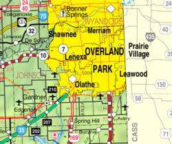
Mission Hills is a city in Johnson County, Kansas, United States,[1] and part of the Kansas City Metropolitan Area. As of the 2020 census, the population of the city was 3,594.[3] The east city limits is the Kansas-Missouri state line at State Line Road. Mission Hills was originally developed by noted Kansas City developer J. C. Nichols beginning in the 1920s as part of his Country Club District plan.
- ^ a b c d e U.S. Geological Survey Geographic Names Information System: Mission Hills, Kansas
- ^ "2019 U.S. Gazetteer Files". United States Census Bureau. Retrieved July 24, 2020.
- ^ a b "Profile of Mission Hills, Kansas in 2020". United States Census Bureau. Archived from the original on November 23, 2022. Retrieved November 22, 2022.