Back Monduli District CEB Monduli (Distrikt) German Περιοχή Μοντούλι Greek Monduli Spanish District de Monduli French Distretto di Monduli Italian Wilaya ya Monduli Swahili Monduli (huyện) Vietnamese Monduli District Zulu
Monduli District
Wilaya ya Monduli (Swahili) | |
|---|---|
|
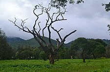
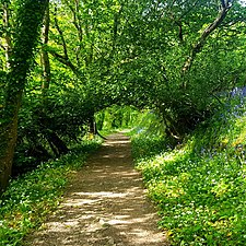
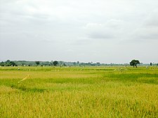
From top to bottom: Coffee plantation in Monduli, Monduli Mountains Forest path and rice plantation in Mto wa Mbu | |
| Nickname: Heart of Arusha | |
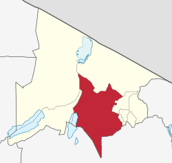
 Monduli District in Arusha | |
| Coordinates: 03°18′10.44″S 36°26′43.08″E / 3.3029000°S 36.4453000°E | |
| Country | |
| Region | Arusha Region |
| Capital | Monduli Mjini |
| Area | |
| • Total | 6,993 km2 (2,700 sq mi) |
| • Rank | 5th in Arusha |
| Highest elevation | 2,660 m (8,730 ft) |
| Population (2022) | |
| • Total | 227,585 |
| • Rank | 6th in Arusha |
| • Density | 33/km2 (84/sq mi) |
| Demonym | Mondulian |
| Ethnic groups | |
| • Settler | Swahili |
| • Native | Maasai, Iraqw & Sonjo |
| Time zone | UTC+3 (EAT) |
| Tanzanian Postcode | 234xx |
| Website | Official website |
| Symbols of Tanzania | |
| Bird |  |
| Mammal | |
'Monduli District (Wilaya ya Monduli, in Swahili) is one of seven districts of the Arusha Region of Tanzania. It is bordered to the north by Longido District, to the east by Arusha Rural District, to the south by the Manyara Region and to the west by Ngorongoro District and Karatu District. The District covers an area of 6,993 km2 (2,700 sq mi).[1] The town of Monduli is the administrative seat of the district. According to the 2002 Tanzania National Census, the population of the Monduli District was 185,237.[2] By 2012, the population of the district was 158,929.[3] By 2022, the population had grown to 227,585.[4]
- ^ "Tanzania: Northern Zone(Districts and Wards) - Population Statistics, Charts and Map".
- ^ "2002 Population and Housing General Report: Arusha: Monduli". Archived from the original on 18 March 2004.
- ^ "2012 Population and Housing Census" (PDF). Development Partners Group Tanzania. Retrieved 7 August 2019.
- ^ "Tanzania: Administrative Division (Regions and Districts) - Population Statistics, Charts and Map". www.citypopulation.de. Retrieved 2024-02-10.


