| Mooney Mooney Central Coast, New South Wales | |||||||||||||||
|---|---|---|---|---|---|---|---|---|---|---|---|---|---|---|---|
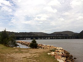
 Mooney Mooney with Deerubbun Reserve in the background | |||||||||||||||
 | |||||||||||||||
| Population | 350 (SAL 2021)[1] | ||||||||||||||
| Postcode(s) | 2083 | ||||||||||||||
| Elevation | 16 m (52 ft) | ||||||||||||||
| Location | |||||||||||||||
| LGA(s) | Central Coast Council | ||||||||||||||
| Parish | Cowan | ||||||||||||||
| State electorate(s) | Gosford | ||||||||||||||
| Federal division(s) | Robertson | ||||||||||||||
| |||||||||||||||


Mooney Mooney is a small waterfront village and suburb of the Central Coast region of New South Wales, Australia. It is located in the Central Coast Council local government area at the end of a peninsula extending southwards into the Hawkesbury River, that is situated 50 kilometres (31 mi) north of Sydney. Mooney Mooney has two islands which are Peat Island and Spectacle Island.
Mooney Mooney is where the Pacific Motorway and Pacific Highway cross from the Central Coast into the Greater Sydney Metropolitan area on the south side of the Hawkesbury River.
- ^ Australian Bureau of Statistics (28 June 2022). "Mooney Mooney (suburb and locality)". Australian Census 2021 QuickStats. Retrieved 20 July 2024.
