Back جبل مونت ارايات ARZ Bukid Arayat BCL Mount Arayat CEB Arayat Czech Arayat (Vulkan) German Monte Aráyat Spanish Arayat mendia Basque کوه آرایات Persian Gunung Arayat ID Bantay Arayat ILO
This article needs additional citations for verification. (October 2019) |
| Mount Arayat | |
|---|---|
 Mount Arayat as seen from Kaledian (Camba), Arayat, Pampanga | |
| Highest point | |
| Elevation | 1,233 m (4,045 ft)[1] |
| Prominence | 998 m (3,274 ft) |
| Listing | potentially active volcano |
| Coordinates | 15°12′00″N 120°44′31″E / 15.20°N 120.742°E |
| Geography | |
| Location | Mount Arayat National Park |
| Country | Philippines |
| Region | Central Luzon |
| Province | Pampanga |
| City/municipality | |
| Geology | |
| Mountain type | Stratovolcano |
| Volcanic arc/belt | Luzon Volcanic Arc |
| Last eruption | Holocene |
 | |

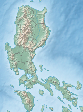
Mount Arayat is an isolated potentially active stratovolcano in the Central Luzon plains, Philippines. Located within vast agricultural lands of Pampanga province, it rises prominently to a height of 1,033 metres (3,389 ft) above sea level. Its southern half lies within the municipality of Arayat, while its north half and summit lies within Magalang. Ten miles (16 km) to the west of Mount Arayat is Angeles City and the former Clark Air Base. The active volcano Mount Pinatubo is located 26 km (16 mi) west, while Manila is located 75 km (47 mi) to the south. Mount Arayat was officially declared a national park in 1933 and a tourist spot in 1997.[2][3][4] The mountain is currently under an immense deforestation threat.[5]
Mount Arayat has a breached crater on its northwest side with a smaller andesitic dome in the collapse amphitheater. There are historical records of eruption in Arayat and the only dated rocks are 530- and 650-thousand-year-old basalts predating the collapse and formation of the lava dome. However, weak steaming is currently present in some of the heavily eroded vents on the North Western side of the summit. Additionally an analysis report indicates that the volcano erupted over the last 2,000 years, but it is believed to refer to the volcanic activity of the volcano.[1]
Mount Arayat is considered mystical in ancient Kapampangan folklore as the legendary home of Aung/Aring Sinukuan/Sinkuan/Suku or the Fairy known as diwata Maria Sinukuan. According to research gathered by Kapampangan students of Henry Otley Beyer, the mountain was the abode of Apung/Aring Sinukuan, rival of Apu Namalyari of Mount Pinatubo.[citation needed]
- ^ a b "Arayat". Global Volcanism Program. Smithsonian Institution. Retrieved December 19, 2010.
- ^ Flora, Ian Ocampo (October 3, 2018). "Mt. Arayat soon a protected landscape". Sunstar. Archived from the original on November 10, 2019. Retrieved November 10, 2019.
- ^ "Proclamation No. 203, s. 1937". Official Gazette of the Republic of the Philippines. Archived from the original on November 10, 2019. Retrieved November 10, 2019.
- ^ "Republic Act No. 7690". Official Gazette of the Republic of the Philippines. Archived from the original on November 10, 2019. Retrieved November 10, 2019.
- ^ Dagamac, Nikki Heherson; Stephenson, Steven; Dela Cruz, Thomas Edison (May 14, 2012). "Occurrence, distribution and diversity ofmyxomycetes (plasmodial slime moulds) along two transects in Mt. Arayat National Park, Pampanga, Philippines". Mycology. 3 (2): 119–126. doi:10.1080/21501203.2011.637088. S2CID 83490685.

