Back جبل مونت ارتشير ARZ Mount Archer (bukid sa Ostralya, State of Queensland, Rockhampton) CEB Mount Archer German ماونت آرچر، کوئینزلند (منطقه راکهمپتون) Persian Mount Archer LLD Mount Archer (berg i Australien, Queensland, Rockhampton) Swedish
| Mount Archer Queensland | |||||||||||||||
|---|---|---|---|---|---|---|---|---|---|---|---|---|---|---|---|
 Mount Archer, 2022 | |||||||||||||||
 | |||||||||||||||
| Coordinates | 23°19′48″S 150°34′49″E / 23.33°S 150.5802°E | ||||||||||||||
| Population | 77 (2021 census)[1] | ||||||||||||||
| • Density | 3.263/km2 (8.45/sq mi) | ||||||||||||||
| Postcode(s) | 4701 | ||||||||||||||
| Area | 23.6 km2 (9.1 sq mi) | ||||||||||||||
| Time zone | AEST (UTC+10:00) | ||||||||||||||
| LGA(s) | Rockhampton Region | ||||||||||||||
| State electorate(s) | Keppel | ||||||||||||||
| Federal division(s) | Capricornia | ||||||||||||||
| |||||||||||||||
| Mount Archer | |
|---|---|
| Highest point | |
| Elevation | 604 m (1,982 ft) |
| Coordinates | 23°20′00″S 150°34′58″E / 23.3333°S 150.5828°E |
| Geography | |
| Location | Queensland, Australia |
| Parent range | Berserker Range |
| Climbing | |
| Easiest route | Road |
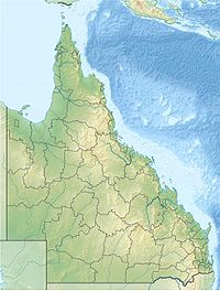
Mount Archer is a suburb of Rockhampton and a mountain in the Rockhampton Region, Queensland, Australia.[2][3][4] In the 2021 census, Mount Archer had a population of 77 people.[1]
- ^ a b Cite error: The named reference
Census2021was invoked but never defined (see the help page). - ^ "Mount Archer – suburb in Rockhampton Region (entry 48778)". Queensland Place Names. Queensland Government. Retrieved 27 January 2020.
- ^ "Mount Archer – mountain in the Rockhampton REgion (entry 767)". Queensland Place Names. Queensland Government. Retrieved 29 January 2020.
- ^ "Mount Archer (entry 48778)". Queensland Place Names. Queensland Government. Retrieved 8 August 2015.

