Back Barrage de Mullaperiyar French मुल्लापेरियार बांध Hindi മുല്ലപ്പെരിയാർ അണക്കെട്ട് Malayalam முல்லைப் பெரியாறு அணை Tamil
| Mullaperiyar Dam | |
|---|---|
 | |
| Country | India |
| Location | Kerala |
| Coordinates | 9°31′43″N 77°8′39″E / 9.52861°N 77.14417°E |
| Status | Operational |
| Construction began | 1887 |
| Opening date | 10 October 1895[1] |
| Operator(s) | Tamil Nadu |
| Dam and spillways | |
| Type of dam | Gravity |
| Impounds | Periyar River |
| Height (foundation) | 53.66 m (176 ft)[2] |
| Length | 365.85 m (1,200 ft) (main)[2] |
| Width (crest) | 3.6 m (12 ft) |
| Width (base) | 42.2 m (138 ft)[3] |
| Spillways | 13[4] |
| Spillway type | Chute |
| Spillway capacity | 3,454.62 cubic metres per second (4,518 cu yd/s)[2] |
| Reservoir | |
| Total capacity | 443,230,000 m3 (359,332 acre⋅ft) (15.65 tmc ft) |
| Active capacity | 299,130,000 m3 (242,509 acre⋅ft)[5] (10.56 tmc ft) |
| Maximum water depth | 43.281 m (142 ft) |
| Power Station | |
| Operator(s) | Tamil Nadu Generation and Distribution Corporation Limited |
| Commission date | Unit 1:1958 Unit 2: 1959 Unit 3:1959 Unit 4:1965 |
| Turbines | 3 x 42 MW 1 x 35 MW[6] |
| Installed capacity | 161 MW |
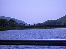
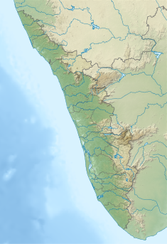
Mullaperiyar Dam (IPA: [mulːɐpːeɾijɐːr]) is a masonry gravity dam on the Periyar River of Idukki district of Indian state of Kerala. It is situated 150km south east of Kochi and 200km north east of state capital city of Trivandrum.[2][3] It is located 881 m (2,890 ft) above the sea level, on the Cardamom Hills of the Western Ghats in Thekkady, Idukki District of Kerala, India. It was constructed between 1887 and 1895 by John Pennycuick and also reached in an agreement to divert water eastwards to the Madras Presidency area (present-day Tamil Nadu). It has a height of 53.6 m (176 ft) from the foundation, and a length of 365.7 m (1,200 ft).[2] The Periyar National Park in Thekkady is located around the dam's reservoir. The dam is built at the confluence of Mullayar and Periyar rivers. The dam is located in Kerala on the river Periyar,[2][7] but is operated and maintained by the neighbouring state of Tamil Nadu.[2][8][9] Although the Periyar River has a total catchment area of 5398 km2 with 114 km2 downstream from the dam in Tamil Nadu,[10][11] the catchment area of the Mullaperiyar Dam itself lies entirely in Kerala and thus not an inter-State river.[12][13][14] On 21 November 2014, the water level hit 142 feet for first time in 35 years.[15] The reservoir again hit the maximum limit of 142 feet on 15 August 2018, following incessant rains in the state of Kerala. In a 2021 UNU-INWEH report about ageing large dams around the world, Mullaperiyar was said to be "situated in a seismically active area with significant structural flaws and poses risk to 3.5 million people if the 100+ years old dam were to fail".[16][17]
- ^ "Mullaperiyar Dam turns 125 | Kochi News - Times of India". The Times of India. TNN. 10 October 2020. Archived from the original on 7 April 2022. Retrieved 3 August 2021.
- ^ a b c d e f g "National Register for Large Dams" (PDF). India: Central Water Commission. 2009. pp. 194–197. Archived from the original (PDF) on 21 July 2011. Retrieved 30 November 2011.
- ^ a b Cite error: The named reference
Frye1918was invoked but never defined (see the help page). - ^ ET Bureau (2 December 2011). "Tamil Nadu tells Supreme Court to restrain Kerala on Mullaiperiyar dam". Economic Times. Archived from the original on 3 December 2013. Retrieved 6 December 2011.
- ^ Cite error: The named reference
studywas invoked but never defined (see the help page). - ^ "Archived copy" (PDF). Archived from the original (PDF) on 10 January 2020. Retrieved 8 April 2020.
{{cite web}}: CS1 maint: archived copy as title (link) - ^ "Medium River Basins Of The Country" (PDF). Ministry of Water Resources, Government of India. Archived from the original (PDF) on 19 January 2012. Retrieved 10 January 2012.
- ^ "Tamil Nadu since the state is incontrovertible sole owner of the Mullaperiyar dam and all its appurtenant structures – Tamil Nadu Chief Minister Jayalalithaa". The Times of India. 9 February 2012. Archived from the original on 6 July 2022. Retrieved 18 September 2023.
- ^ "Four dams – Mullaperiyar Dam, Parambikulam Dam, Thunakadavu Dam and Peruvaripallam Dam – are owned, operated and maintained by Tamil Nadu whereas they were situated in the territory of Kerala – Tamil Nadu Chief Minister Jayalalithaa". Archived from the original on 20 October 2014. Retrieved 5 May 2012.
- ^ Water insecurity, institutions, and livelihood dynamics: a study in Plachimada, Kerala, India. India: Centre for Development Studies (Trivandrum, India). 2012. p. 58. Archived from the original on 3 January 2016. Retrieved 11 August 2012.
- ^ Kaul, Bansi Lal (2012). Advances in Fish and Wildlife Ecology and Biology, Volume 4. India. p. 29. ISBN 978-81-7035-517-5. Archived from the original on 18 September 2023. Retrieved 22 September 2016.
{{cite book}}: CS1 maint: location missing publisher (link) - ^ "The Mullaperiyar Conflict" (PDF). India: National Institute of Advanced Studies. 2010. p. 7. Archived from the original (PDF) on 15 December 2011. Retrieved 10 August 2012.
- ^ "No part of Mullaperiyar catchment is in TN: CWRDM Director". The Hindu. India. 2012. Archived from the original on 10 January 2012. Retrieved 10 August 2012.
- ^ "Dam Break Analysis". India: IIT Roorkee. 2012. pp. 17–22. Archived from the original on 21 September 2013. Retrieved 10 August 2012.
- ^ "The Mullaperiyar touches 142 feet". The Times of India. India. 2014. Archived from the original on 11 September 2019. Retrieved 22 November 2014.
- ^ "Kerala's Mullaperiyar dam is a ticking time bomb waiting to explode". The Scroll. Archived from the original on 20 July 2023. Retrieved 18 September 2023.
- ^ "Ageing dams pose growing threat". United Nations University. Archived from the original on 7 December 2022. Retrieved 18 September 2023.


