| Ilford | |
|---|---|
 Ilford (now Redbridge) Town Hall | |
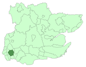
 Ilford within Essex in 1961 | |
| Area | |
| • 1911 | 8,496 acres (34.38 km2)[1] |
| • 1931 | 8,493 acres (34.37 km2)[1] |
| • 1961 | 8,404 acres (34.01 km2)[1] |
| Population | |
| • 1911 | 78,188[1] |
| • 1931 | 131,061[1] |
| • 1961 | 178,024[1] |
| Density | |
| • 1911 | 9.2/acre |
| • 1931 | 15.4/acre |
| • 1961 | 21.2/acre |
| History | |
| • Origin | Chadwell and Ilford wards of Barking parish |
| • Created | 1888 |
| • Abolished | 1965 |
| • Succeeded by | London Borough of Redbridge |
| Status | Civil parish (1888—1965) Local board (1890—1894) Urban district (1894—1926) Municipal borough (1926—1965) |
| Government | |
| • HQ | Ilford |
| • Motto | In unity progress |
 Achievement of arms of the Borough Council | |
Ilford was a civil parish and local government district in south west Essex, England from 1888 to 1965, covering the town Ilford. The district saw a considerable rise in population throughout its life,[1] caused by the expansion of the built-up area of London, and became one of the most populous districts of its type in England. The district now corresponds to the greater part of the London Borough of Redbridge in Greater London.
