Back مورشيسون (مقاطعه تاسمان) ARZ Murchison (lungsod sa New Zealand) CEB Murchison (Neuseeland) German Murchison, New Zealand Malay Murchison (Nowa Zelandia) Polish
Murchison | |
|---|---|
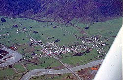
 Aerial view of Murchison in 1978 | |
 | |
| Coordinates: 41°48′S 172°20′E / 41.800°S 172.333°E | |
| Country | New Zealand |
| Territorial authority | Tasman |
| Ward | Lakes-Murchison Ward |
| Electorates | |
| Government | |
| • Territorial Authority | Tasman District Council |
| • Mayor of Tasman | Tim King |
| • West Coast-Tasman MP | Maureen Pugh |
| • Te Tai Tonga MP | Tākuta Ferris |
| Area | |
| • Total | 4.34 km2 (1.68 sq mi) |
| Population (June 2024)[2] | |
| • Total | 480 |
| • Density | 110/km2 (290/sq mi) |
| Postcode(s) | 7007 |
| Area code | 03 |
Murchison is a town in the Tasman Region of the South Island of New Zealand. It is near the western end of the "Four Rivers Plain", at the confluence of the Buller River and the Mātakitaki River. The other two rivers are the Mangles River, and the Matiri River. It is a rural service town for the surrounding mixed farming district, approximately halfway between Westport and Nelson. Murchison was named after the Scottish geologist Roderick Murchison, one of the founders of the Royal Geographical Society.[3]
- ^ Cite error: The named reference
Areawas invoked but never defined (see the help page). - ^ "Aotearoa Data Explorer". Statistics New Zealand. Retrieved 26 October 2024.
- ^ "Murchison". NZHistory.net.nz. Retrieved 8 February 2016.