Back Murchison Falls National Park (parke) CEB Murchison-Falls-Nationalpark German Parque nacional de las Cataratas Murchison Spanish Murchisonin putouksen kansallispuisto Finnish Parc national Murchison Falls French הפארק הלאומי מרצ'יסון פולס HE Taman Nasional Murchison Falls ID Parco nazionale delle Cascate Murchison Italian マーチソン・フォールズ国立公園 Japanese Ekkuumiro ly'ebisoro erya Murchison Falls LG
| Murchison Falls National Park | |
|---|---|
| Kabalega National Park | |
 | |
| Location | Uganda |
| Nearest city | Masindi |
| Coordinates | 02°11′15″N 31°46′53″E / 2.18750°N 31.78139°E |
| Area | 3,893 km2 (1,503 sq mi) |
| Established | 1952 |
| Governing body | Ugandan Wildlife Authority |
| Official name | Murchison Falls-Albert Delta Wetland System |
| Designated | 15 September 2006 |
| Reference no. | 1640[1] |
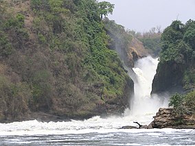
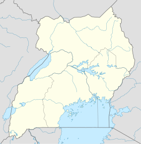
Murchison Falls National Park (MFNP) is a national park in Uganda managed by the Ugandan Wildlife Authority. Located in north-western Uganda, it spreads inland from the shores of Lake Albert, around the Victoria Nile, up to the Karuma Falls.[2]
Together with the adjacent 748 square kilometres (289 sq mi) Bugungu Wildlife Reserve and the 720 square kilometres (280 sq mi) Karuma Wildlife Reserve, the park forms the Murchison Falls Conservation Area (MFCA).[3] As of 2022, the East African Crude Oil Pipeline being built includes the construction of 10 oil well pads, a feeder pipeline, and a refinery in and around the Murchison Falls national park.[4]
- ^ "Murchison Falls-Albert Delta Wetland System". Ramsar Sites Information Service. Retrieved 25 April 2018.
- ^ Cite error: The named reference
Seewas invoked but never defined (see the help page). - ^ UWA (3 November 2016). "About Murchison Falls National Park". Kampala: Uganda Wildlife Authority (UWA). Retrieved 3 November 2016.
- ^ Cite error: The named reference
oilwas invoked but never defined (see the help page).
