Back ناجوان Arabic নগাঁও জিলা Assamese नगांव जिला Bihari নগাঁও জেলা Bengali/Bangla নগাঁও BPY Districte de Nowgong Catalan Nagaon (Distrikt) German Distrito de Nagaon Spanish بخش نگاون Persian Nagaonin piirikunta Finnish
Nagaon | |
|---|---|
 View of Kolong river in Nagaon | |
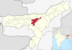
 Location in Assam | |
| Country | |
| State | Assam |
| Division | Central Assam |
| Headquarters | Nagaon |
| Government | |
| • Lok Sabha constituencies | Kaliabor, Nowgong |
| • Vidhan Sabha constituencies | Raha, Dhing, Batadroba, Rupohihat, Nowgong, Barhampur, Samaguri, Kaliabor |
| Area | |
• Total | 2,287 km2 (883 sq mi) |
| Population | |
• Total | 1,892,550 |
| • Density | 830/km2 (2,100/sq mi) |
| ISO 3166 code | IN-AS |
| Website | nagaon |
Nagaon district [nɔgaʊ zila] is an administrative district in the Indian state of Assam. At the time of the 2011 census it was the most populous district in Assam, before Hojai district was split from it in 2016.[1]