| Natchaug River | |
|---|---|
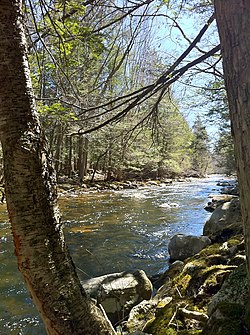
 Bigelow Brook from the Natchaug Trail in Eastford Connecticut, the head waters of the Natchaug River. | |
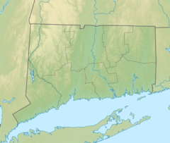
| Location | |
| Country | United States |
| State | Connecticut |
| Counties | Tolland, Windham |
| Physical characteristics | |
| Source | Confluence of Still River and Bigelow Brook. Nearby Charlie Brown Campground |
| • location | Eastford, Windham County, Connecticut, United States |
| • coordinates | 41°51′51″N 72°05′24″W / 41.86406°N 72.09005°W |
| Mouth | Confluence with Willimantic River to form Shetucket River |
• location | Willimantic, Windham County, Connecticut, United States |
• coordinates | 41°42′46″N 72°11′30″W / 41.71278°N 72.19167°W[1] |
The Natchaug River is a 17.9-mile-long (28.8 km)[2] river in Windham and Tolland Counties in northeastern Connecticut. The name Natchaug comes from the Nipmuc language and is believed to mean land between rivers.[3]
- ^ "Geographic Names Information System Feature Detail Report: Natchaug River". United States Geological Survey. September 12, 1979. Retrieved 2007-06-04.
- ^ U.S. Geological Survey. National Hydrography Dataset high-resolution flowline data. The National Map, accessed April 1, 2011
- ^ Kinnicutt, Lincoln N. (1905). Indian Names of Places in Worcester County Massachusetts with Interpretations of Some of Them (PDF). Worcester, MA. p. 30. Retrieved October 22, 2020.
{{cite book}}: CS1 maint: location missing publisher (link)

