Back نهر نيوشو Arabic نهر نيوشو ARZ Neosho River CEB Неошо CV Neosho River Danish Río Neosho Spanish Neosho (rivière) French Neosho (fiume) Italian Niošas Lithuanian Neosho (rivier) Dutch
| Neosho River | |
|---|---|
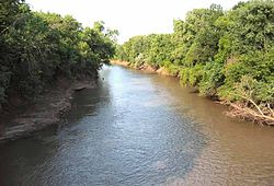
 Neosho River near Neosho Rapids, Kansas | |
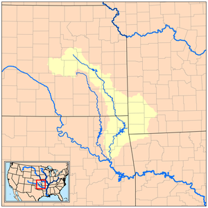
 Map of the Neosho River and its watershed | |
| Location | |
| Country | United States |
| State | Kansas, Oklahoma |
| Physical characteristics | |
| Source | Near White City, Kansas |
| • coordinates | 38°47′22″N 96°44′39″W / 38.78944°N 96.74417°W[1] |
| • elevation | 1,450 ft (440 m)[2] |
| Mouth | Arkansas River |
• coordinates | 35°47′32″N 95°17′40″W / 35.79222°N 95.29444°W[1] |
• elevation | 489 ft (149 m)[1] |
| Length | 463 mi (745 km) |
| Basin size | 11,534 sq mi (29,870 km2)[3] |
| Discharge | |
| • location | USGS gage 07191500 near Chouteau, OK[3] |
| • average | 8,954 cu ft/s (253.5 m3/s)[3] |
| • minimum | 12 cu ft/s (0.34 m3/s) |
| • maximum | 154,000 cu ft/s (4,400 m3/s) |


The Neosho River is a tributary of the Arkansas River in eastern Kansas and northeastern Oklahoma in the United States. Its tributaries also drain portions of Missouri and Arkansas. The river is about 463 miles (745 km) long.[4] Via the Arkansas, it is part of the Mississippi River watershed. Its name is an Osage word meaning "clear water."[5] The lower section is also known as the Grand River.
- ^ a b c U.S. Geological Survey Geographic Names Information System: Neosho River
- ^ USGS topographic maps
- ^ a b c "Water resources data for the United States, Water Year 2009; gage 07191500, Neosho River near Chouteau, OK" (PDF). USGS. Retrieved August 1, 2010.
- ^ U.S. Geological Survey. National Hydrography Dataset high-resolution flowline data. The National Map, accessed May 31, 2011
- ^ Muskogee Phoenix. "How places got their names." Archived 2012-07-12 at archive.today June 5, 2007. Retrieved October 11, 2013.