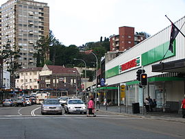
New South Head Road | |
|---|---|
 | |
| New South Head Road, Double Bay | |
| Coordinates |
|
| General information | |
| Type | Road |
| Length | 7.0 km (4.3 mi)[1] |
| Gazetted | August 1928[2] |
| Former route number | |
| Major junctions | |
| Southwest end | William Street Bayswater Road Rushcutters Bay, Sydney |
| |
| Northeast end | Old South Head Road Vaucluse, Sydney |
| Location(s) | |
| Major suburbs | Edgecliff, Double Bay, Point Piper, Rose Bay |
| ---- | |
New South Head Road is a major road in the Eastern Suburbs of Sydney, linking the inner-eastern suburb of Rushcutters Bay to the southern reaches of the South Head peninsula.
- ^ "New South Head Road" (Map). Google Maps. Google. 19 August 2022. Retrieved 19 August 2022.
- ^ "Main Roads Act, 1924-1927". Government Gazette of the State of New South Wales. No. 110. National Library of Australia. 17 August 1928. pp. 3814–20. Archived from the original on 3 August 2022. Retrieved 1 August 2022.

