| Ngunnawal Canberra, Australian Capital Territory | |||||||||||||||
|---|---|---|---|---|---|---|---|---|---|---|---|---|---|---|---|
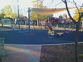
 Playground in Ngunnawal | |||||||||||||||
 | |||||||||||||||
| Coordinates | 35°10′33″S 149°06′33″E / 35.17583°S 149.10917°E | ||||||||||||||
| Population | 10,957 (SAL 2021)[1] | ||||||||||||||
| Established | 24 April 1992 | ||||||||||||||
| Postcode(s) | 2913 | ||||||||||||||
| Elevation | 629 m (2,064 ft) | ||||||||||||||
| Area | 4.2 km2 (1.6 sq mi) | ||||||||||||||
| Location |
| ||||||||||||||
| District | Gungahlin | ||||||||||||||
| Territory electorate(s) | Yerrabi | ||||||||||||||
| Federal division(s) | Fenner | ||||||||||||||
| |||||||||||||||
Ngunnawal (/ŋʌnəwəl/) is a suburb in the district of Gungahlin in Canberra, Australia. The suburb is named in tribute to the Ngunnawal people, the original inhabitants of the area. The suburb was gazetted on 24 April 1992.[2] Ngunnawal is adjacent to the suburbs of Nicholls, Casey, Moncrieff, Amaroo and Gungahlin. It is bounded by Gungahlin Drive, Horse Park Drive, Gundaroo Drive and Mirrabei Drive. Ginninderra Creek is situated near Ngunnawal's eastern boundary. The suburb is located approximately 4 km from the Gungahlin Town Centre and about 13 km from the centre of Canberra.
- ^ Australian Bureau of Statistics (28 June 2022). "Ngunnawal (suburb and locality)". Australian Census 2021 QuickStats. Retrieved 28 June 2022.
- ^ "Suburb Name search results". ACT Environment and Sustainable Development. Retrieved 10 February 2014.

