Back North Fremantle CEB North Fremantle Italian North Fremantle Malagasy North Fremantle Swedish شمالی فریمینٹل، مغربی آسٹریلیا Urdu
| North Fremantle Beeliar Perth, Western Australia | |||||||||||||||
|---|---|---|---|---|---|---|---|---|---|---|---|---|---|---|---|
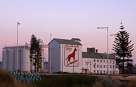
 Dingo Flour mill | |||||||||||||||
 | |||||||||||||||
| Coordinates | 32°02′02″S 115°45′22″E / 32.034°S 115.756°E | ||||||||||||||
| Population | 3,947 (SAL 2021)[1] | ||||||||||||||
| Established | 1851 | ||||||||||||||
| Postcode(s) | 6159[2] | ||||||||||||||
| Elevation | 35 m (115 ft) | ||||||||||||||
| Time zone | Australian Western Standard Time (AWST +8) (UTC) | ||||||||||||||
| Location | |||||||||||||||
| LGA(s) | City of Fremantle | ||||||||||||||
| State electorate(s) | Cottesloe | ||||||||||||||
| Federal division(s) | Fremantle | ||||||||||||||
| |||||||||||||||
| |||||||||||||||
North Fremantle is a suburb of Perth, Western Australia, located within the City of Fremantle, a local government area of the state. Its postcode is 6159.[2]
North Fremantle is situated on a peninsula, with the Indian Ocean bounding the west side and the Swan River the east side. On the north side it is separated from the suburb of Mosman Park by McCabe Street. North Fremantle has one train station, located on Stirling Highway, which provides train services into Fremantle and Perth city. There are various bus stations in North Fremantle, providing access to outer Perth suburbs.[3]
- ^ Australian Bureau of Statistics (28 June 2022). "North Fremantle (suburb and locality)". Australian Census 2021 QuickStats. Retrieved 28 June 2022.
- ^ a b North Fremantle Postcode Australia Post
- ^ Wagovau. (2016). Wagovau. Retrieved 17 May 2016, from http://www.transperth.wa.gov.au/