Back Propinsi Samar Utara ACE سامار الشمالية Arabic قوزئی سامار AZB Northern Samar BCL Samar Septentrional Catalan Northern Samar CBK-ZAM Amihanang Samar CEB Northern Samar German Norda Samaro Esperanto Sámar del Norte Spanish
This article needs additional citations for verification. (April 2013) |
Northern Samar
Hilagang Samar (Filipino) | |
|---|---|
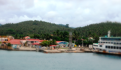
(from top: left to right) Rock formations in Biri, Dalupiri Island, Church of Bobon, Provincial Capitol, San Vicente Islands and Port of Allen. | |
 | |
| Coordinates: 12°20′N 124°40′E / 12.33°N 124.67°E | |
| Country | Philippines |
| Region | Eastern Visayas |
| Founded | June 19, 1965 |
| Capital and largest municipality | Catarman |
| Government | |
| • Type | Sangguniang Panlalawigan |
| • Governor | Edwin C. Ongchuan (PFP) |
| • Vice Governor | Clarence E. Dato (PFP) |
| • Legislature | Northern Samar Provincial Board |
| Area | |
• Total | 3,692.93 km2 (1,425.85 sq mi) |
| • Rank | 34th out of 81 |
| Highest elevation | 514 m (1,686 ft) |
| Population (2020 census)[2] | |
• Total | 639,186 |
| • Rank | 48th out of 81 |
| • Density | 170/km2 (450/sq mi) |
| • Rank | 51st out of 81 |
| Divisions | |
| • Independent cities | 0 |
| • Component cities | 0 |
| • Municipalities | |
| • Barangays | 569 |
| • Districts | Legislative districts of Northern Samar |
| Time zone | UTC+8 (PHT) |
| ZIP code | 6400–6423 |
| IDD : area code | +63 (0)55 |
| ISO 3166 code | PH-NSA |
| Spoken languages | |
| Highway routes | |
| Website | northernsamar |
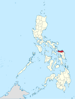
Northern Samar (Waray: Amihanan Samar/Norte san Samar; Tagalog: Hilagang Samar[3]), officially the Province of Northern Samar, is a province in the Philippines located in the Eastern Visayas region. Its capital is Catarman, the most populous town in the province and is located at the northern portion of the island of Samar. Bordering the province to the south are the provinces of Samar and Eastern Samar. To the northwest, across the San Bernardino Strait is Sorsogon; to the east is the Philippine Sea of the Pacific Ocean and to the west is Samar Sea.
- ^ "List of Provinces". PSGC Interactive. Makati City, Philippines: National Statistical Coordination Board. Retrieved April 12, 2013.
- ^ Census of Population (2020). "Region VIII (Eastern Visayas)". Total Population by Province, City, Municipality and Barangay. Philippine Statistics Authority. Retrieved July 8, 2021.
- ^ "Mapa ng mga Wika (Rehiyon) - Rehiyon VIII" (in Filipino). Commission on the Filipino Language. Retrieved September 23, 2021.


