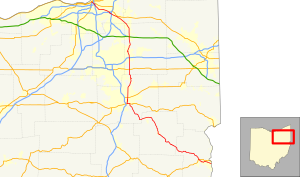
 Route of SR 43 highlighted in red | ||||
| Route information | ||||
| Maintained by ODOT | ||||
| Length | 122.53 mi[1] (197.19 km) | |||
| Existed | 1924–present | |||
| Major junctions | ||||
| South end | ||||
| West end | ||||
| Location | ||||
| Country | United States | |||
| State | Ohio | |||
| Counties | Jefferson, Carroll, Stark, Portage, Geauga, Cuyahoga | |||
| Highway system | ||||
| ||||
| ||||
State Route 43 (SR 43) is a mainly north–south state highway that runs through the northeastern quadrant of the U.S. state of Ohio. Its southern terminus is at a signalized intersection with State Route 7 along the Ohio River in Steubenville, and its western terminus is approximately 123 miles (198 km) to the north at Public Square in Cleveland. It is one of ten routes to enter Public Square.
Created in the mid-1920s, State Route 43 starts out in Steubenville, and runs northwesterly to Canton via Carrollton. From Canton, the highway runs northerly through Kent and Streetsboro to Aurora, where it then turns northwesterly through Solon, Ohio, and continues passing through suburban Cleveland before entering the city proper, and coming to an end in downtown at Public Square. For its northernmost stretch of less than 1 mile (1.6 km), State Route 43 shares the same portion of pavement as four other highways at the same time: U.S. Route 422, State Route 8, State Route 14 and State Route 87. The five routes share a common endpoint in the middle of Public Square, where they intersect the triplex of U.S. Route 6, U.S. Route 42 and State Route 3.

