Back مقاطعة أوين (كنتاكي) Arabic Owen County, Kentucky BAR Оуен (окръг, Кентъки) Bulgarian ৱেন কাউন্টি, কেন্টাকি BPY Owen Gông (Kentucky) CDO Оуэн (гуо, Кентукки) CE Owen County (kondado sa Tinipong Bansa, Kentucky) CEB Owen County, Kentucky Welsh Owen County (Kentucky) German Condado de Owen (Kentucky) Spanish
Owen County | |
|---|---|
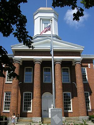
 Owen County courthouse in Owenton | |
 Location within the U.S. state of Kentucky | |
 Kentucky's location within the U.S. | |
| Coordinates: 38°32′N 84°50′W / 38.53°N 84.83°W | |
| Country | |
| State | |
| Founded | 1819 |
| Named for | Abraham Owen |
| Seat | Owenton |
| Largest city | Owenton |
| Area | |
| • Total | 354 sq mi (920 km2) |
| • Land | 351 sq mi (910 km2) |
| • Water | 3.1 sq mi (8 km2) 0.9% |
| Population (2020) | |
| • Total | 11,278 |
| • Estimate (2023) | 11,313
|
| • Density | 32/sq mi (12/km2) |
| Time zone | UTC−5 (Eastern) |
| • Summer (DST) | UTC−4 (EDT) |
| Congressional district | 4th |
| Website | www |
Owen County is a county located in the northern part of the U.S. state of Kentucky. Its county seat is Owenton.[1] The county is named for Colonel Abraham Owen.[2] It is a prohibition or dry county, with the exception of a winery that is authorized to sell its product to the public,[3] and limited sales within the incorporated city limits of Owenton.[4]
- ^ "Find a County". National Association of Counties. Retrieved June 7, 2011.
- ^ The Register of the Kentucky State Historical Society, Volume 1. Kentucky State Historical Society. 1903. pp. 36.
- ^ "Wet & Dry Counties in Kentucky" (PDF). Kentucky Office of Alcoholic Beverage Control. Archived from the original (PDF) on March 15, 2007. Retrieved March 21, 2007.
- ^ "Voters approve alcohol by the drink in Owenton". Owenton News Herald. Retrieved September 17, 2014.