Back Oxnanardu ANG أوكسنارد Arabic اوكسنارد ARZ اوکسنارد، کالیفورنیا AZB Окснард Byelorussian Окснард (Каліфорнія) BE-X-OLD Окснард Bulgarian Oxnard Catalan Окснард CE Oxnard CEB
Oxnard, California | |
|---|---|
|
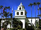
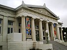
Clockwise: Channel Islands Harbor; Carnegie Art Museum; hotel at the beach | |
| Nickname(s): Gateway to the Channel Islands, The Nard[1] | |
 Location in Ventura County and the state of California | |
| Coordinates: 34°11′29″N 119°10′57″W / 34.19139°N 119.18250°W | |
| Country | United States |
| State | California |
| County | Ventura |
| Region | Oxnard Plain |
| Incorporated | June 30, 1903[2] |
| Named for | Henry T. Oxnard |
| Government | |
| • Type | Council–manager |
| • Mayor | John Zaragoza |
| • City council[4] |
|
| • City treasurer | Phil Molina |
| • City clerk | Rose Chaparro[3] |
| • City manager | Alexander Nguyen |
| Area | |
• City | 39.14 sq mi (101.38 km2) |
| • Land | 26.53 sq mi (68.70 km2) |
| • Water | 12.62 sq mi (32.68 km2) 31.41% |
| Elevation | 52 ft (16 m) |
| Population | |
• City | 202,063 |
| • Rank | 1st in Ventura County 22nd in California 126th in the United States |
| • Density | 7,616.40/sq mi (2,940.71/km2) |
| • Urban | 376,117 (US: 109th) |
| • Urban density | 4,909.7/sq mi (1,895.6/km2) |
| • Metro | 843,843 (US: 71st) |
| Time zone | UTC−8 (Pacific) |
| • Summer (DST) | UTC−7 (PDT) |
| ZIP Codes[8] | 93030–93036 |
| Area codes | 805 and 820 |
| FIPS code | 06-54652 |
| GNIS feature IDs | 1652766, 2411347 |
| Website | oxnard |
Oxnard (/ˈɒksnɑːrd/ ⓘ) is a city in Ventura County in the U.S. state of California, United States. On California's Central Coast, it is the most populous city in Ventura County and the 22nd-most-populous city in California. Incorporated in 1903, Oxnard lies approximately 60 miles (97 km) northwest of downtown Los Angeles.
It is at the western edge of the fertile Oxnard Plain, adjacent to agricultural fields with strawberries, lima beans and other vegetable crops. Oxnard is also a major transportation hub in Southern California, with Amtrak, Union Pacific, Metrolink, Greyhound, and Intercalifornias stopping there. It also has a small regional airport, Oxnard Airport (OXR). The town also has significant connections to the nearby oil fields Oxnard Oil Field and the West Montalvo Oil Field. The high density of oil, industry, and agricultural activities around the city, has led to several environmental issues.[9]
Oxnard's population was 202,063 in 2020,[10] and is largely Latino.[9] It is the most populous city in the Oxnard–Thousand Oaks–Ventura, CA Metropolitan Statistical Area.
- ^ Cite error: The named reference
WVCBA 2018-06-19was invoked but never defined (see the help page). - ^ "California Cities by Incorporation Date". California Association of Local Agency Formation Commissions. Archived from the original (Word) on November 3, 2014. Retrieved August 25, 2014.
- ^ "City Clerk". City of Oxnard. Retrieved February 9, 2015.
- ^ "City Council Members". City of Oxnard. Retrieved December 8, 2014.
- ^ "2019 U.S. Gazetteer Files". United States Census Bureau. Retrieved July 1, 2020.
- ^ "Oxnard". Geographic Names Information System. United States Geological Survey, United States Department of the Interior. Retrieved December 10, 2014.
- ^ "Oxnard (city) QuickFacts". United States Census Bureau. Archived from the original on September 7, 2012. Retrieved March 11, 2015.
- ^ "ZIP Code(tm) Lookup". United States Postal Service. Retrieved November 30, 2014.
- ^ a b "Oxnard residents are fighting slag heaps, power plants and oil fields that mar the town's beaches". Los Angeles Times. July 9, 2017. Retrieved May 26, 2022.
- ^ "US Census Bureau QuickFacts Oxnard (City)". Retrieved September 9, 2021.


