Oyama | |
|---|---|
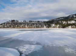
 Looking across frozen Kalamalka Lake from Kaloya Regional Park | |
| Coordinates: 50°07′00″N 119°22′00″W / 50.11667°N 119.36667°W | |
| Country | |
| Province | |
| Regional district | Central Okanagan |
| District | Lake Country |
| Population | 985 |
Oyama is a neighbourhood and formal ward located within the district municipality of Lake Country, which is located in the Okanagan region in British Columbia, Canada. It is located at the north end of Wood Lake and at the south end of Kalamalka Lake opposite BC Highway 97.[1]
