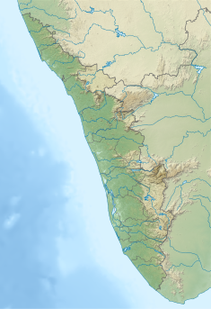
| Pamba Dam | |
|---|---|
 | |
| Country | India |
| Location | Pathanamthitta, Kerala |
| Coordinates | 9°23′26″N 77°09′35″E / 9.3906°N 77.1598°E |
| Purpose | Power |
| Status | Operational |
| Opening date | 1967 |
| Owner(s) | Kerala State Electricity Board |
| Dam and spillways | |
| Type of dam | Gravity dam |
| Impounds | Pamba river |
| Height (foundation) | 57.2 m (188 ft) |
| Length | 281.48 m (923.5 ft) |
| Elevation at crest | 981.46 m (3,220.0 ft) |
| Spillways | 6 nos, radial gates, each of size 7.0 x 4.87 m |
| Spillway capacity | 912 m3/s (32,200 cu ft/s) |
| Reservoir | |
| Creates | Pamba Reservoir |
| Total capacity | 39,220,000 m3 (1.385×10⁹ cu ft) |
| Catchment area | 90.88 km2 (35.09 sq mi) |
| Maximum water depth | 986.33 m (3,236.0 ft) |
| Normal elevation | 986.33 m (3,236.0 ft) |
| Sabarigiri Power Station | |
| Coordinates | 9°18′36″N 77°04′22″E / 9.31000°N 77.07278°E |
| Operator(s) | Kerala State Electricity Board |
| Commission date | 1967 |
| Turbines | 2 x 60 MW & 4 x 55 MW (Pelton-type) |
| Installed capacity | 340 MW |
| Annual generation | 1338 MU |
| Website Official website | |
Pamba Dam is a gravity dam built on the Pamba river in the Ranni forest area of Seethathodu panchayat in Pathanamthitta district of Kerala, India.[1] It was built in 1967 as part of the Sabarigiri Hydroelectric Project. Sabarigiri Hydro Electric Project (IHEP) is the second largest hydro electric project in Kerala.[2] Pamba dam's reservoir is connected to the nearby Kakki dam's reservoir by a 3.21 km (1.99 mi) long underground tunnel. The dam is 281 m (922 ft) long and 57.2 m (188 ft) high and is located at an elevation of 981.45 m (3,220.0 ft) above sea level. The dam is located in a forest area adjacent to the Periyar National Park. The water stored in the Pamba and Kakki dams is conveyed to the Sabarigiri powerhouse through penstock pipes. The dam was commissioned in 1967.[3]
- ^ "Pamba Dam – KSEB Limited Dam Safety Organisation". Retrieved 2021-07-21.
- ^ "Kerala State Electricity Board Limited - Pamba Basin HydroProjects". www.kseb.in. Retrieved 2021-07-07.
- ^ Liji, Samuel; Prasad, Dr. A.K. (September 2018). "Hydro Electric Power Dams in Kerala and Environmental Consequences from Socio-Economic Perspectives" (PDF). International Journal of Research and Analytical Reviews. 5 (3).


