| Petit Jean State Park | |
|---|---|
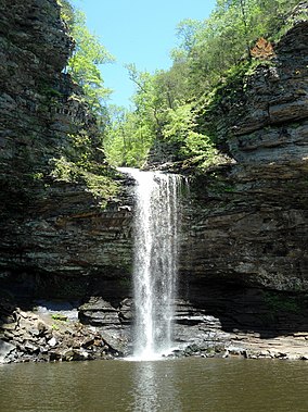
 Cedar Falls | |
| Location | Conway County, Arkansas River Valley, Arkansas, United States |
| Coordinates | 35°07′N 92°56′W / 35.12°N 92.94°W |
| Area | 3,471 acres (14.05 km2) |
| Established | 1923 |
| Named for | Petit Jean Mountain |
| Governing body | Arkansas Department of Parks and Tourism |
| Website | www |
Petit Jean State Park is a 3,471-acre (1,405 ha) park in Conway County, Arkansas managed by the Arkansas Department of Parks and Tourism. It is located on top of Petit Jean Mountain next to the Arkansas River in the area between the Ouachita Mountains and the Ozark Plateaus.


