Back پای تاون، نیومکزیکو AZB Пай-Таун (Нью-Мексико) CE Pie Town CEB Pie Town (Nuevo México) Spanish پای تاون، نیومکزیکو Persian Pie Town French Pie Town, Novi Meksiko Croatian Pie Town Italian Pie Town (New Mexico) LLD Masdéél (Yootó Hahoodzo) NV
Pie Town, New Mexico | |
|---|---|
 | |
| Motto: America's Friendliest Little Town | |
| Coordinates: 34°20′24″N 108°10′15″W / 34.34000°N 108.17083°W[1] | |
| Country | United States |
| State | New Mexico |
| County | Catron County |
| Area | |
| • Total | 57.3 sq mi (148.4 km2) |
| • Land | 57.3 sq mi (148.3 km2) |
| • Water | 0.04 sq mi (0.1 km2) |
| Elevation | 7,536 ft (2,297 m) |
| Population (2020) | |
| • Total | 111 |
| • Density | 3/sq mi (1.3/km2) |
| Time zone | UTC−7 (MST) |
| • Summer (DST) | UTC−6 (MDT) |
| ZIP Code | 87827 |
| Area code | 575 |
| GNIS feature ID | 2584176[1] |
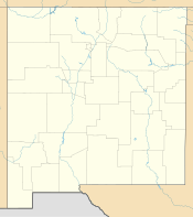
Pie Town is an unincorporated community and census-designated place located along U.S. Highway 60 in Catron County, New Mexico. As of the 2010 census, it had a population of 186.[2] Pie Town's name comes from an early bakery that specialized in dried-apple pies, established by Clyde Norman in the early 1920s.[citation needed] Pie Town has been noted for its colorful place name.[3] Pie Town is the location of a "Pie Festival" on the second Saturday of each September.[4] Pie Town is located immediately north of the Gila National Forest and not very far west of the Plains of San Agustin, the location of the Very Large Array radio telescope, which is also located along U.S. 60. In addition, one of the ten large radio antennas that form the Very Long Baseline Array of the National Radio Astronomy Observatory can be seen from U.S. 60, just east of Pie Town.
- ^ a b c U.S. Geological Survey Geographic Names Information System: Pie Town, New Mexico
- ^ "Geographic Identifiers: 2010 Demographic Profile Data (G001): Pie Town CDP, New Mexico". U.S. Census Bureau, American Factfinder. Archived from the original on February 12, 2020. Retrieved October 16, 2014.
- ^ Symons, Mitchell (November 8, 2012). The Bumper Book For The Loo: Facts and figures, stats and stories – an unputdownable treat of trivia. Transworld. p. 270. ISBN 978-1-4481-5271-1.
- ^ "Pie Town, New Mexico, Pie Festival USA". Pie Town Festival USA. Pie Town Festival USA. Retrieved July 28, 2018.

