| Platt Fields Park | |
|---|---|
 | |
 | |
| Type | Municipal park |
| Location | Fallowfield, Manchester, England |
| Coordinates | 53°26′54″N 2°13′28″W / 53.4483°N 2.2245°W |
| Area | 70 hectares (170 acres) [1] |
| Created | 1908 |
| Operated by | Manchester City Council |
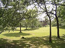
Platt Fields Park is a large public park in Fallowfield, Manchester, England which is home to Platt Hall. Fallowfield lies to the south and Wilmslow Road runs along its eastern edge. Its north-eastern corner is close to the start of the Curry Mile.
- ^ "Platt Fields Park - Manchester". Visit Manchester. Retrieved 5 October 2020.
