| Point Lookout State Park | |
|---|---|
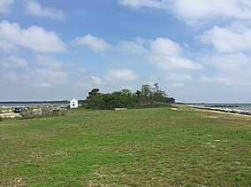
 View north from the lighthouse at Point Lookout | |
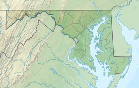
| Location | 11175 Point Lookout Road, Scotland, Maryland |
| Nearest town | Lexington Park, Maryland |
| Coordinates | 38°02′15″N 76°19′18″W / 38.03750°N 76.32167°W[1] |
| Area | 1,083 acres (4.38 km2)[2] |
| Designation | Maryland state park |
| Established | 1964[3] |
| Administrator | Maryland Department of Natural Resources |
| Website | Point Lookout State Park |
Point Lookout State Park is a public recreation area and historic preserve occupying Point Lookout, the southernmost tip of a peninsula formed by the confluence of Chesapeake Bay and the Potomac River in St. Mary's County, Maryland. The state park preserves the site of an American Civil War prisoner of war camp and the Point Lookout Light, which was built in 1830.[4] It is the southernmost spot on Maryland's western shore, the coastal region on the western side of the Chesapeake Bay.
- ^ "Point Lookout". Geographic Names Information System. United States Geological Survey, United States Department of the Interior.
- ^ Cite error: The named reference
acreagereportwas invoked but never defined (see the help page). - ^ Cite error: The named reference
mdnr2was invoked but never defined (see the help page). - ^ Cite error: The named reference
mdnr3was invoked but never defined (see the help page).

