Back Port Campbell National Park CEB Port Campbell National Park German پارک ملی پورت کمبل Persian Parc national de Port Campbell French Պորտ Քեմփբել Armenian ポートキャンベル国立公園 Japanese Taman Negara Port Campbell Malay Nationaal park Port Campbell Dutch Port Campbell National Park Polish Parque Nacional de Port Campbell Portuguese
| Port Campbell National Park Victoria | |
|---|---|
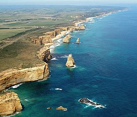
 Port Campbell National Park coastline | |
 | |
| Nearest town or city | Port Campbell |
| Coordinates | 38°39′02″S 143°03′46″E / 38.65056°S 143.06278°E |
| Established | 5 May 1964[1] |
| Area | 17.5 km2 (6.8 sq mi)[1] |
| Visitation | circa 2,000,000 (in 1998)[1] |
| Managing authorities | Parks Victoria |
| Website | Port Campbell National Park |
| See also | Protected areas of Victoria |
The Port Campbell National Park is a national park in the south-western district of Victoria, Australia. The 1,750-hectare (4,300-acre) national park is situated approximately 190 kilometres (120 mi) south-west of Melbourne and approximately 10 kilometres (6.2 mi) east of Warrnambool. The park is located adjacent to the Great Otway National Park and the Bay of Islands Coastal Park.
- ^ a b c "Port Campbell National Park and Bay of Islands Coastal Park management plan" (PDF). Parks Victoria (PDF). Government of Victoria. September 1998. pp. 3–5, 26. ISBN 0-7311-3133-9. Archived from the original (PDF) on 4 March 2016. Retrieved 25 August 2014.
