Back بورت فيرى ARZ Port Fairy CEB Port Fairy German Port Fairy Esperanto بندر فیری Persian Port Fairy French Port Fairy Scots/Gaelic Port Fairy ID Port Fairy Malagasy Port Fairy Dutch
| Port Fairy Victoria | |||||||||
|---|---|---|---|---|---|---|---|---|---|
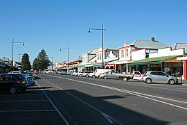
 The main shopping precinct | |||||||||
| Coordinates | 38°22′0″S 142°14′0″E / 38.36667°S 142.23333°E | ||||||||
| Population | 3,340 (2016 census)[1] | ||||||||
| Established | 1843 | ||||||||
| Postcode(s) | 3284 | ||||||||
| Elevation | 6 m (20 ft) | ||||||||
| Location |
| ||||||||
| LGA(s) | Shire of Moyne | ||||||||
| State electorate(s) | South-West Coast | ||||||||
| Federal division(s) | Wannon | ||||||||
| |||||||||
Port Fairy (historically known as Belfast) is a coastal town in south-western Victoria, Australia. It lies on the Princes Highway in the Shire of Moyne, 28 kilometres (17 mi) west of Warrnambool and 290 kilometres (180 mi) west of Melbourne, at the point where the Moyne River enters the Southern Ocean.
