The Indiana Portal
Various indigenous peoples inhabited what would become Indiana for thousands of years, some of whom the U.S. government expelled between 1800 and 1836. Indiana received its name because the state was largely possessed by native tribes even after it was granted statehood. Since then, settlement patterns in Indiana have reflected regional cultural segmentation present in the Eastern United States; the state's northernmost tier was settled primarily by people from New England and New York, Central Indiana by migrants from the Mid-Atlantic states and adjacent Ohio, and Southern Indiana by settlers from the Upland South, particularly Kentucky and Tennessee.
Indiana has a diverse economy with a gross state product of $352.62 billion in 2021. It has several metropolitan areas with populations greater than 100,000 and a number of smaller cities and towns. Indiana is home to professional sports teams, including the NFL's Indianapolis Colts the NBA's Indiana Pacers, and the WNBA's Indiana Fever. The state also hosts several notable competitive events, such as the Indianapolis 500, held at Indianapolis Motor Speedway. (Full article...)
Selected article -
Indiana, a state in the Midwest, played an important role in supporting the Union during the American Civil War. Despite anti-war activity within the state, and southern Indiana's ancestral ties to the South, Indiana was a strong supporter of the Union. Indiana contributed approximately 210,000 Union soldiers, sailors, and marines. Indiana's soldiers served in 308 military engagements during the war; the majority of them in the western theater, between the Mississippi River and the Appalachian Mountains. Indiana's war-related deaths reached 25,028 (7,243 from battle and 17,785 from disease). Its state government provided funds to purchase equipment, food, and supplies for troops in the field. Indiana, an agriculturally rich state containing the fifth-highest population in the Union, was critical to the North's success due to its geographical location, large population, and agricultural production. Indiana residents, also known as Hoosiers, supplied the Union with manpower for the war effort, a railroad network and access to the Ohio River and the Great Lakes, and agricultural products such as grain and livestock. The state experienced two minor raids by Confederate forces, and one major raid in 1863, which caused a brief panic in southern portions of the state and its capital city, Indianapolis.
Indiana experienced significant political strife during the war, especially after Governor Oliver P. Morton suppressed the Democratic-controlled state legislature, which had an anti-war (Copperhead) element. Major debates related to the issues of slavery and emancipation, military service for African Americans, and the draft, ensued. These led to violence. In 1863, after the state legislature failed to pass a budget and left the state without the authority to collect taxes, Governor Morton acted outside his state's constitutional authority to secure funding through federal and private loans to operate the state government and avert a financial crisis. (Full article...)
Selected image -
Did you know -
- ... that an "army" of women were congratulated by Pat Nixon for their fundraising efforts to bring public TV to Indianapolis?
- ... that the existence of Lego Indiana Jones 2: The Adventure Continues was accidentally leaked when it was displayed on an animator's résumé?
- ... that after becoming "convinced of the evils of slavery", James Townsend left Kentucky for Indiana?
- ... that Ganggang, an Indianapolis-based cultural development firm for Black artists, created a fine art fair called "Butter" that also included a dance party called "Melt"?
- ... that the Indianapolis Community Food Access Coalition was created to resolve food deserts in the city of Indianapolis?
- ... that a woman hitchhiked from Indiana to Washington, D.C., to protest the sale of the radio station where she worked?
Related portals
Selected geographic article -

Blackford County is located in the east central portion of the U.S. state of Indiana. The county is named for Judge Isaac Blackford, who was the first speaker of the Indiana General Assembly and a long-time chief justice of the Indiana Supreme Court. Created in 1838, Blackford County is divided into four townships, and its county seat is Hartford City. Two incorporated cities and one incorporated town are located within the county. The county is also the site of numerous unincorporated communities and ghost towns. Occupying only 165.58 square miles (428.9 km2), Blackford County is the fourth smallest county in Indiana. As of the 2020 census, the county's population was 12,112. Based on population, the county is the 8th smallest county of the 92 in Indiana. Although no interstate highways are located in Blackford County, three Indiana state roads cross the county, and an additional state road is located along the county's southeast border. The county has two railroad lines. A north–south route crosses the county, and intersects with a second railroad line that connects Hartford City with communities to the west.
Before the arrival of European-American settlers during the 1830s, the northeastern portion of the future Blackford County was briefly the site of an Indian reservation for Chief Francois Godfroy of the Miami tribe. The first European-American pioneers were typically farmers who settled on arable land near rivers. Originally, the county was mostly swampland, but more land became available for farming as the marshes were cleared and drained. Over the next 30 years, small communities developed throughout the county. When the county's rail lines were constructed in the 1860s and 1870s, additional communities evolved around railroad stops. (Full article...)
Selected biography -
William Marrion Branham (April 6, 1909 – December 24, 1965) was an American Christian minister and faith healer who initiated the post-World War II healing revival, and claimed to be a prophet with the anointing of Elijah, who had come to prelude Christ's second coming; some of his followers have been labeled a "doomsday cult". He is credited as "a principal architect of restorationist thought" for charismatics by some Christian historians, and has been called the "leading individual in the Second Wave of Pentecostalism." He made a lasting influence on televangelism and the modern charismatic movement, and his "stage presence remains a legend unparalleled in the history of the Charismatic movement". At the time they were held, Branham's inter-denominational meetings were the largest religious meetings ever held in some American cities. Branham was the first American deliverance minister to successfully campaign in Europe; his ministry reached global audiences with major campaigns held in North America, Europe, Africa, and India.
Branham claimed that he had received an angelic visitation on May 7, 1946, commissioning his worldwide ministry and launching his campaigning career in mid-1946. His fame rapidly spread as crowds were drawn to his stories of angelic visitations and reports of miracles happening at his meetings. His ministry spawned many emulators and set in motion the broader healing revival that later became the modern charismatic movement. At the peak of his popularity in the 1950s, Branham was widely adored and "the neo-Pentecostal world believed Branham to be a prophet to their generation". From 1955, Branham's campaigning and popularity began to decline as the Pentecostal churches began to withdraw their support from the healing campaigns for primarily financial reasons. By 1960, Branham transitioned into a teaching ministry. (Full article...)
Selected quote
General images
Topics
- Economy: AM General - ATA Airlines - Casinos - Cummins - Delta - ITT - JayC - Lilly - Limestone - Manufacturing - NiSource - Shoe Carnival - Simon Property Group - Soybeans - Studebaker - Vectren - WellPoint
- Geography: Caves - Lakes - Rivers - State forests - Watersheds
Categories
Attractions
 |
Recognized content
| This is a list of recognized content, updated weekly by JL-Bot (talk · contribs) (typically on Saturdays). There is no need to edit the list yourself. If an article is missing from the list, make sure it is tagged (e.g. {{WikiProject Indiana}}) or categorized correctly and wait for the next update. See WP:RECOG for configuration options. |
Good articles
- 1925 Tri-State tornado
- 1963 Indiana State Fairgrounds Coliseum gas explosion
- 2006 Brickyard 400
- 2011 South Bend mayoral election
- 2015 South Bend mayoral election
- 2019 South Bend mayoral election
- 2021 NCAA Division I men's basketball championship game
- Max Bielfeldt
- The Fault in Our Stars (film)
- Hurley Goodall
- R. Ames Montgomery
- Proposed South Shore Line station in South Bend
- Richmond, Indiana, facility fire
- WCAE
Featured pictures
-
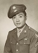
Kenje Ogata 1943
-
Kurt Vonnegut by Bernard Gotfryd (1965)
-
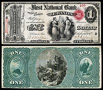
US-NBN-IL-Lebanon-2057-Orig-1-400-C
WikiProjects
State facts
Indiana | |
|---|---|
| Country | United States |
| Admitted to the Union | December 11, 1816 (19th) |
| Capital | Indianapolis |
| Largest city | Indianapolis |
| Largest metro and urban areas | Indianapolis-Carmel MSA |
| Government | |
| • Governor | Eric Holcomb (R) (2017) |
| • Lieutenant Governor | Suzanne Crouch (R) (2017) |
| Legislature | Indiana General Assembly |
| • Upper house | Senate |
| • Lower house | House of Representatives |
| U.S. senators | Todd Young (R) Mike Braun (R) |
| Population | |
• Total | 6,080,485 |
| • Density | 169.5/sq mi (65.46/km2) |
| Language | |
| • Official language | English |
| Latitude | 37° 46′ N to 41° 46′ N |
| Longitude | 84° 47′ W to 88° 6′ W |
Things you can do
 |
Here are some tasks awaiting attention:
|
Associated Wikimedia
The following Wikimedia Foundation sister projects provide more on this subject:
-
Commons
Free media repository -
Wikibooks
Free textbooks and manuals -
Wikidata
Free knowledge base -
Wikinews
Free-content news -
Wikiquote
Collection of quotations -
Wikisource
Free-content library -
Wikiversity
Free learning tools -
Wikivoyage
Free travel guide -
Wiktionary
Dictionary and thesaurus
- ^ a b "Elevations and Distances in the United States". U.S Geological Survey. 29 April 2005. Retrieved 2006-11-06.
{{cite web}}: CS1 maint: year (link)


