Back Portland (Connecticut) Catalan Портленд (Коннектикут) CE Portland (lungsod sa Tinipong Bansa, Connecticut) CEB Portland, Connecticut Welsh Portland (Connecticut) German Portland (Connecticut) Spanish Portland (Connecticut) Basque پورتلند، کنتیکت Persian Portland (Connecticut) French Portland, Connecticut HT
Portland, Connecticut | |
|---|---|
| Town of Portland | |
 Main Street in Portland facing toward the town hall | |
| Nickname: Quarry Town | |
| Coordinates: 41°34′21″N 72°38′26″W / 41.57250°N 72.64056°W | |
| Country | |
| U.S. state | |
| County | Middlesex |
| Region | Lower CT River Valley |
| Incorporated | 1841 |
| Government | |
| • Type | Selectman-town meeting |
| Area | |
| • Total | 64.5 km2 (24.9 sq mi) |
| • Land | 60.6 km2 (23.4 sq mi) |
| • Water | 3.8 km2 (1.5 sq mi) |
| Elevation | 48 m (157 ft) |
| Population (2020) | |
| • Total | 9,384 |
| • Density | 154.9/km2 (401/sq mi) |
| Time zone | UTC-5 (Eastern) |
| • Summer (DST) | UTC-4 (Eastern) |
| ZIP code | 06480 |
| Area code(s) | 860/959 |
| FIPS code | 09-61800 |
| GNIS feature ID | 0213491[1] |
| Website | http://www.portlandct.org/ |
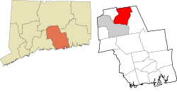
Portland (/ˈpɔːrtlənd/ PORT-lənd) is a town in Middlesex County, Connecticut, United States. The town is part of the Lower Connecticut River Valley Planning Region. The population was 9,384 at the 2020 census.[2] The town center is listed as a census-designated place (CDP). It is situated across the Connecticut River from Middletown.
Brownstone quarried in Portland was used in the construction of Hartford's Old State House in 1796. The vast majority of the brownstone buildings in Connecticut (see College Row at Wesleyan University and the Long Walk at Trinity College) as well as the famous brownstones in New York City were built with brownstone from Portland's quarries. Later, one of the quarries was transformed into an adventure park in the summer months featuring zip lines, cliff diving and scuba locations.
About half of the town's perimeter is made up of the Connecticut River. The town has eight marinas and boat clubs as well as three 18-hole golf courses.[3]
- ^ a b U.S. Geological Survey Geographic Names Information System: Portland, Connecticut
- ^ "Census - Geography Profile: Portland town, Middlesex County, Connecticut". Retrieved December 20, 2021.
- ^ Cite error: The named reference
inbriefwas invoked but never defined (see the help page).


