Back পোরূর Bengali/Bangla পোরুর BPY Porur CEB Porur Spanish Porur Italian Porur Malagasy Porur Malay Porur Dutch Porur Swedish போரூர் Tamil
This article possibly contains original research. (February 2019) |
Porur | |
|---|---|
Greater Chennai Corporation Limits | |
 | |
| Coordinates: 13°02′18″N 80°09′23″E / 13.038200°N 80.156500°E | |
| Country | India |
| State | Tamil Nadu |
| District | Chennai |
| Taluk | Maduravoyal |
| Zone | Central Chennai Zone |
| Government | |
| • Type | Chennai Corporation |
| • Body | Chennai Corporation |
| Area | |
| • Total | 3.78 km2 (1.46 sq mi) |
| Elevation | 43 m (141 ft) |
| Population (2001) | |
| • Total | 28,783 |
| • Density | 7,600/km2 (20,000/sq mi) |
| Languages | |
| • Official | Tamil |
| Time zone | UTC+5:30 (IST) |
| PIN | 600 116 |
| Vehicle registration | TN 10(RTO, Chennai(South West)) |
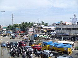
Porur (Tamil: [poːɾuːɾ]) is a neighbourhood of Chennai, India. It is situated in the Maduravoyal taluk of Chennai district in the southern part of the city. Since 2011, it has been a part of the Chennai Corporation and included in zone number 11.[1]
The earliest recorded history of Porur goes back to the Chola period when it served as the headquarters of an administrative division (nadu) called Perur Nadu. Porur Lake is the major source of fresh water for suburban areas such as Iyyapanthangal, Moulivakkam and Mangadu. Porur is also known for the Ramachandra Medical College. Porur houses Mono-pulse Secondary Surveillance radar, one of the two radars in the city, which aids air-transport communication.[2]
- ^ "Corporation of Chennai". 10 June 2020. Archived from the original on 10 June 2020. Retrieved 29 July 2021.
- ^ Janardhanan, Arun (29 September 2011). "Chennai ATC enjoys the navigation of entire South Indian skies". The Times of India (in Tamil). Chennai: The Times Group. Retrieved 1 December 2012.

