Red line (Kaohsiung Metro)

Red line
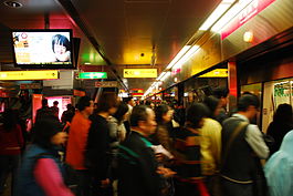
Red line platform at Formosa Boulevard
Overview
LocaleKaohsiung, Taiwan
Termini
Stations25
Service
TypeRapid transit
Operator(s)Kaohsiung Rapid Transit Corporation
Depot(s)North
South
History
Opened9 March 2008 (2008-03-09)
Technical
Line length31.1 km (19.3 mi)
Number of tracks2
CharacterUnderground/At-Grade/Elevated
Track gauge1,435 mm (4 ft 8+12 in) standard gauge
Electrification750 V DC third rail
Route map

Dahu
Luzhu
Luzhu South
Kao Yuan University
Kaohsiung Science District
Benjhou Industrial Park
National Gangshan Agricultural & Industrial
Vocational Senior High School
Gangshan
Kaohsiung Medical University
Gangshan Hospital
Ciaotou
Ciaotou Sugar Refinery
Cingpu
Metropolitan Park
Houjing
Nanzih Export Processing Zone
Oil Refinery Elementary School
World Games
(Taiwan High Speed Rail Right arrow)
Zuoying
Ecological District
Kaohsiung Arena
Aozihdi
Houyi
Kaohsiung Main Station
Kaohsiung Main Station (former site)
Formosa Boulevard
(Left arrow  Right arrow)
Central Park
Sanduo Shopping District
Shihjia
Kaisyuan
(Left arrow  Right arrow)
Cianjhen Senior High School
Caoya
Kaohsiung International Airport Airport interchangeKHH
Siaogang
China Steel East Portal
Labor Training Center
Fongbitou
Gangpu Elementary School
Linyuan
Linyuan Industrial Park
Wufang
Wulong
Donggang
Dapengwan National Scenic
District Management Hall
Dapengwan
Red line
Traditional Chinese紅線
Simplified Chinese红线
Transcriptions
Standard Mandarin
Hanyu PinyinHóng-Xiàn
Wade–GilesHung2- Hsien4
Tongyong PinyinHóng-Siàn
Southern Min
Hokkien POJÂng-Soàⁿ

The Red line is a metro line of Kaohsiung Metro which runs north–south through the city of Kaohsiung, Taiwan. At 31 kilometres (19 mi), it is the fourth-longest metro line in Taiwan, after Taoyuan Airport MRT, Tamsui-Xinyi Line and Zhonghe-Xinlu Line.

There is a plan to extend the line north to Hunei District[citation needed]. This would add 8 stations to the line.

From Wikipedia, the free encyclopedia · View on Wikipedia

Developed by razib.in