Back المقاطعة الإقليمية لشرق كوتيناي Arabic Regional District of East Kootenay CEB Regional District of East Kootenay German District régional d'East Kootenay French Distretto regionale di East Kootenay Italian イースト・クートニー地域 Japanese East Kootenay Polish ضلع ایسٹ کوٹنے PNB Distrito Regional de East Kootenay Portuguese Ист-Кутеней Russian
East Kootenay | |
|---|---|
| Regional District of East Kootenay | |
 | |
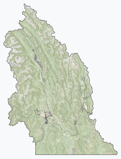
Major communities | |
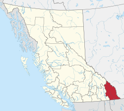
 Location in British Columbia | |
| Coordinates: 49°55′00″N 115°45′00″W / 49.9167°N 115.75°W | |
| Country | Canada |
| Province | British Columbia |
| Administrative office location | Cranbrook |
| Government | |
| • Type | Regional district |
| • Body | Board of directors |
| • Chair | Rob Gay (C) |
| • Vice chair | Susan Clovechok (F) |
| • Electoral areas | A, B, C, E, F, G |
| Area | |
| • Land | 27,541.84 km2 (10,633.96 sq mi) |
| Population (2021)[2] | |
| • Total | 65,896 |
| • Density | 2.4/km2 (6/sq mi) |
| Time zones | |
| Most of the district | UTC-7 (Mountain (MST)) |
| • Summer (DST) | UTC-6 (Mountain Daylight (MDT)) |
| Electoral area C (no DST) | UTC-7 (Mountain (MST)) |
| Website | www |
The Regional District of East Kootenay (RDEK) is a regional district in the Canadian province of British Columbia, Canada. In the 2016 census, the population was 60,439. Its area is 27,542.69 km2 (10,634.29 sq mi). The regional district offices are in Cranbrook, the largest community in the region. Other important population centres include the cities of Kimberley and Fernie, and the district municipality of Invermere and Sparwood. Despite its name, the regional district does not include all of the region known as the East Kootenay, which includes the Creston Valley and the east shore of Kootenay Lake.
- ^ "Board of Directors". Retrieved July 9, 2019.
- ^ a b "Population and dwelling counts, for Canada, provinces and territories, and census divisions, 2016 and 2011 censuses – 100% data (British Columbia)". Statistics Canada. February 8, 2017. Retrieved July 9, 2019.

